
 Overview:
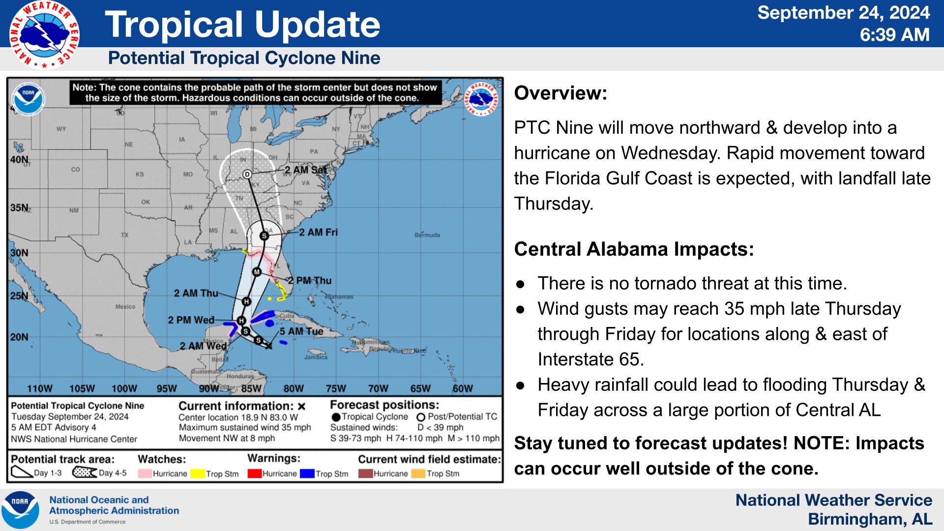
Potential Tropical Cyclone Nine is still trying to get its act together in the western Caribbean, and hasn’t developed into a Tropical Depression just yet as of this morning/early afternoon. NHC is still anticipating a rapid development of this system, becoming what will be named Helene and
developing into a hurricane by Wednesday. Rapid movement northward will occur with landfall expected Thursday night in the Florida Big Bend
region.
Changes from previous forecast:
Very little changes since yesterday, as that system remains a “Potential Tropical Cyclone”.
Highlights/Tornado:
* No tornado threat is currently anticipated.
Wind:
* Wind gusts may reach 30 to 35 mph late Thursday through the day on
Friday for the eastern half of Central Alabama, or roughly along and
east of the I-65 corridor.
Flooding:
* Flooding could become the greatest impact with this system – with the
potential of 2 to 4 inches of rain and with locally higher amounts across
much of Central AL Thursday through Friday.