Marion-Lamar-Fayette-Winston-Walker-Blount-Etowah-Calhoun-Cherokee-Cleburne-Pickens-Tuscaloosa-Jefferson-Shelby-St. Clair-Talladega-Clay-Randolph-Sumter-Greene-Hale-Perry-Bibb-Chilton-Coosa-Tallapoosa-Chambers-Marengo-Dallas-Autauga-Lowndes-Elmore-Montgomery-Macon-Bullock-Lee-Russell-Pike-Barbour-
This Hazardous Weather Outlook is for the counties served by the National Weather Service office in Birmingham.
.DAY ONE…Outlook through Tonight.
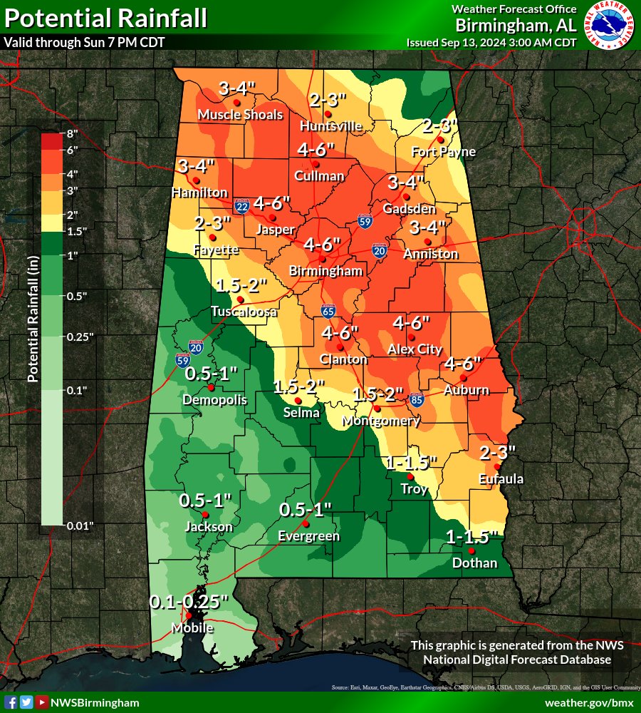
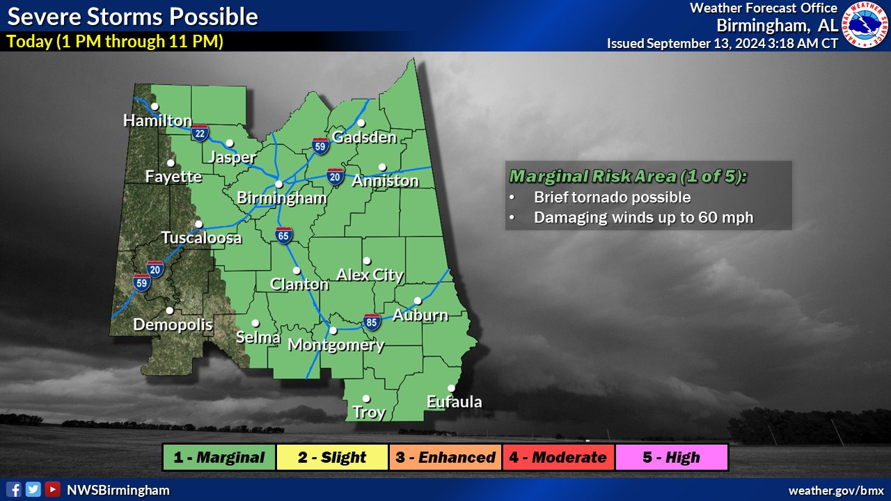
Showers and thunderstorms are forecast across Central Alabama today, posing continued threats for locally heavy rainfall and flooding, as well as isolated damaging wind gusts and tornadoes.
.DAYS TWO THROUGH SEVEN…Saturday through Thursday.
No hazardous weather is expected at this time.
.SPOTTER INFORMATION STATEMENT…
Activation of storm spotters and emergency management may be needed today.
Stay with WEIS 100.5 FM & 990 AM for all the latest weather updates.