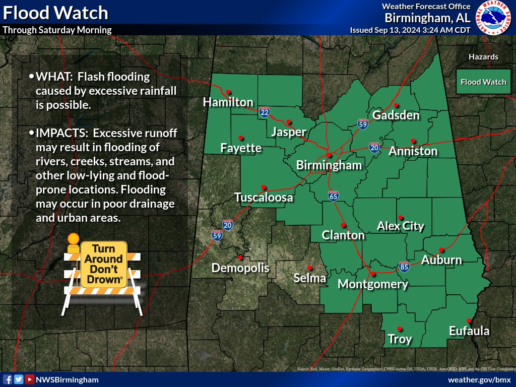
The National Weather Service in Birmingham has extended a FLOOD WATCH for most of Central Alabama, including Cherokee, Calhoun, Cleburne, and Etowah Counties, through Saturday morning, Sept. 14.
…FLOOD WATCH NOW IN EFFECT THROUGH SATURDAY MORNING…
* WHAT…Flash flooding caused by excessive rainfall continues to be possible.
* WHERE…A portion of central Alabama, including the following counties, Autauga, Barbour, Bibb, Blount, Bullock, Calhoun, Chambers, Cherokee, Chilton, Clay, Cleburne, Coosa, Elmore, Etowah, Fayette, Jefferson, Lamar, Lee, Lowndes, Macon, Marion, Montgomery, Pike, Randolph, Russell, Shelby, St. Clair, Talladega, Tallapoosa, Tuscaloosa, Walker and Winston.
* WHEN…Through Saturday morning.
* IMPACTS…Excessive runoff may result in flooding of rivers, creeks, streams, and other low-lying and flood-prone locations. Flooding may occur in poor drainage and urban areas.
* ADDITIONAL DETAILS…
– http://www.weather.gov/safety/flood
PRECAUTIONARY/PREPAREDNESS ACTIONS…
You should monitor later forecasts and be prepared to take action should Flash Flood Warnings be issued.
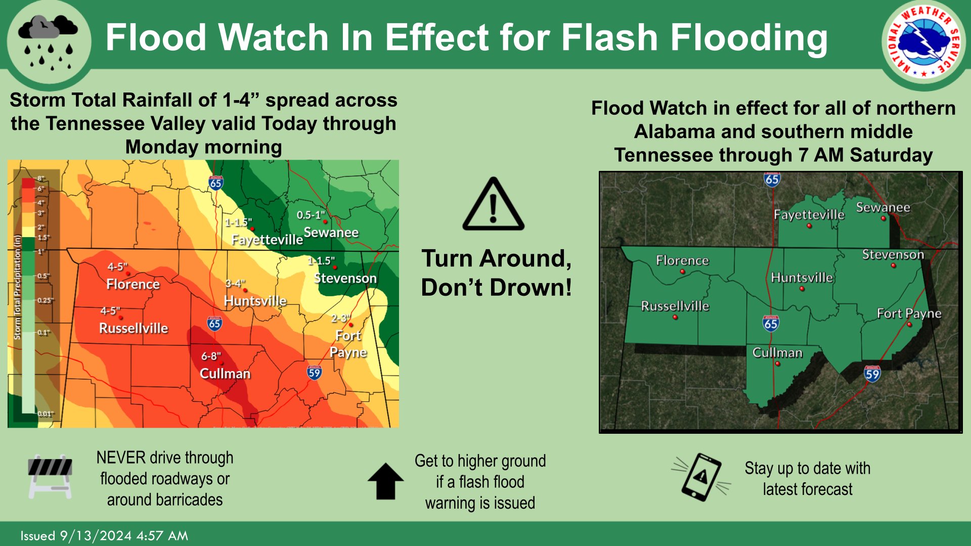
A FLOOD WATCH has also been issued by the National Weather Service of Huntsville for North Alabama, including DeKalb and Marshall Counties, through 7 a.m. Saturday, Sept. 14.
Stay with WEIS 100.5 FM & 990 AM for all the latest weather updates.