Hazardous Weather Outlook/National Weather Service Birmingham AL
Marion-Lamar-Fayette-Winston-Walker-Blount-Etowah-Calhoun-Cherokee-Cleburne-Pickens-Tuscaloosa-Jefferson-Shelby-St. Clair-Talladega-Clay-Randolph-Sumter-Greene-Hale-Perry-Bibb-Chilton-Coosa-Tallapoosa-Chambers-Marengo-Dallas-Autauga-Lowndes-Elmore-Montgomery-Macon-Bullock-Lee-Russell-Pike-Barbour
This Hazardous Weather Outlook is for the counties served by the National Weather Service office in Birmingham.
.DAY ONE…Outlook through Tonight.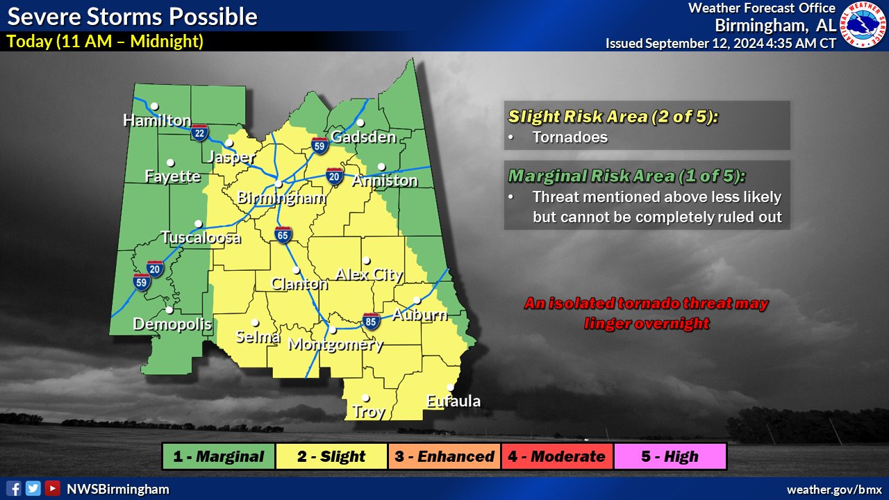
Francine is moving northward through Mississippi today, bringing impacts across Central Alabama. Shower and thunderstorm activity will pose threats for locally heavy rainfall and flooding through tonight. Strongest storms will also pose a threat for tornadoes.
.DAYS TWO THROUGH SEVEN…Friday through Wednesday.
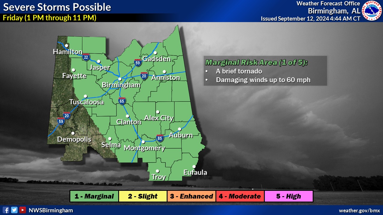
Additional showers and thunderstorms are forecast across Central Alabama on Friday, posing continued threats for locally heavy rainfall and flooding, as well as isolated damaging wind gusts and tornadoes.
.SPOTTER INFORMATION STATEMENT…
Activation of storm spotters and emergency management may be needed through Friday.