 Flood Watch/National Weather Service Birmingham AL
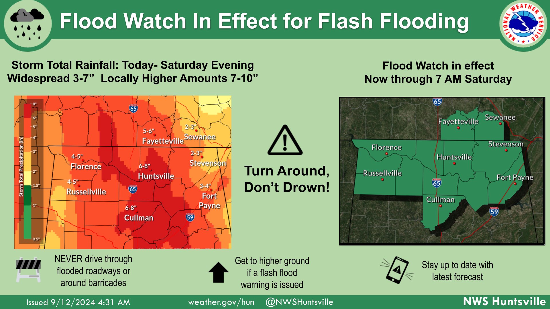
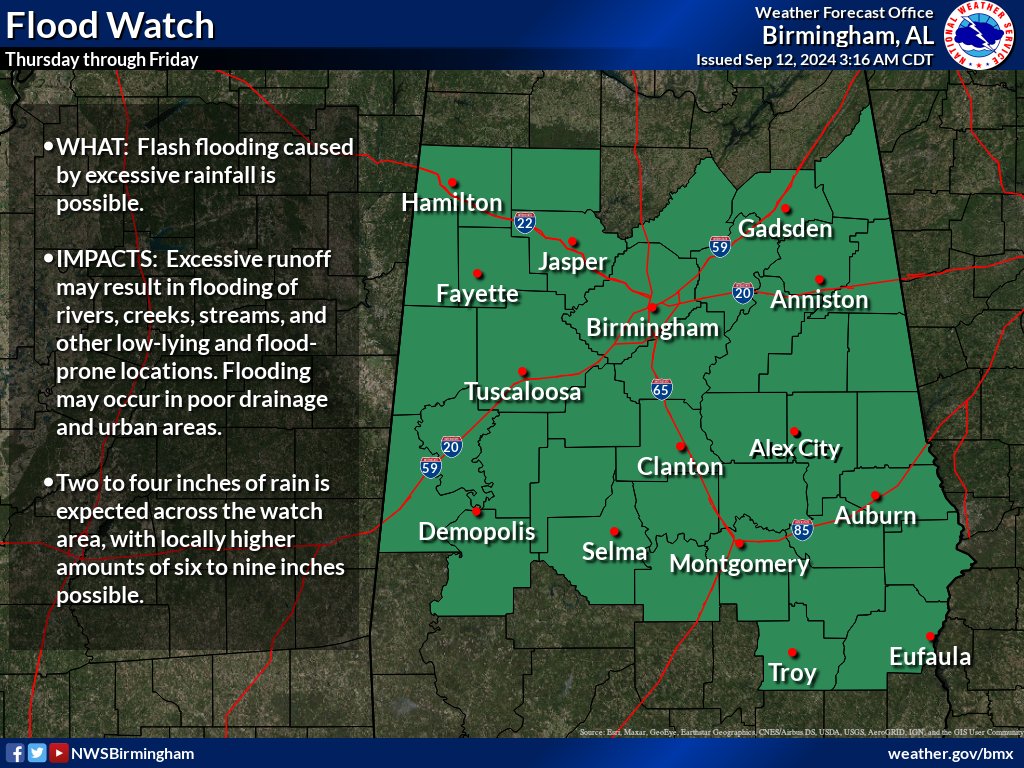
Locally heavy rainfall is forecast across Central Alabama through Friday due to waves of showers and thunderstorms associated with Francine. Two to four inches of rain is expected across the watch area, with locally higher amounts of six to nine inches possible due to training thunderstorms. Urban and flash flooding are the main concerns, including significant flash flooding potential in areas impacted by the highest rainfall amounts.
Marion-Lamar-Fayette-Winston-Walker-Blount-Etowah-Calhoun-Cherokee-Cleburne-Pickens-Tuscaloosa-Jefferson-Shelby-St. Clair-Talladega-Clay-Randolph-Sumter-Greene-Hale-Perry-Bibb-Chilton-Coosa-Tallapoosa-Chambers-Marengo-Dallas-Autauga-Lowndes-Elmore-Montgomery-Macon-Lee / Including the cities of Hoover, Sylacauga, Wetumpka, Tuscaloosa, Demopolis, Ashland, Talladega, Gadsden, Alabaster, Jasper, Columbiana, Carrollton, Vernon, Fayette, Oneonta, Tallassee, Double Springs, Marion, Clanton, Opelika, Alexander City, Livingston, Lanett, Linden, Hamilton, Hayneville, Tuskegee, Centreville, Anniston, Fort Deposit, Prattville, Roanoke, Eutaw, Heflin, Moody, Montgomery, Auburn, Lafayette, Pell City, Centre, Dadeville, Pelham, Selma, Sulligent, Birmingham, Valley, Greensboro, Rockford, and Moundville
FLOOD WATCH NOW IN EFFECT THROUGH FRIDAY EVENING
* WHAT
Flash flooding caused by excessive rainfall continues to be possible.
* WHERE
A portion of central Alabama, including the following counties, Autauga, Bibb, Blount, Calhoun, Chambers, Cherokee, Chilton, Clay, Cleburne, Coosa, Dallas, Elmore, Etowah, Fayette, Greene, Hale, Jefferson, Lamar, Lee, Lowndes, Macon, Marengo, Marion, Montgomery, Perry, Pickens, Randolph, Shelby, St. Clair, Sumter, Talladega, Tallapoosa, Tuscaloosa, Walker and Winston.
* WHEN
Through Friday evening.
* IMPACTS
Excessive runoff may result in flooding of rivers, creeks, streams, and other low-lying and flood-prone locations. Flooding may occur in poor drainage and urban areas.
* ADDITIONAL DETAILS
– http://www.weather.gov/safety/flood
PRECAUTIONARY/PREPAREDNESS ACTIONS
You should monitor later forecasts and also be prepared to take action should Flash Flood Warnings be issued.
A FLOOD WATCH has also been issued by the National Weather Service of Huntsville for North Alabama, including DeKalb and Marshall Counties, through 7am Saturday, Sept. 14.