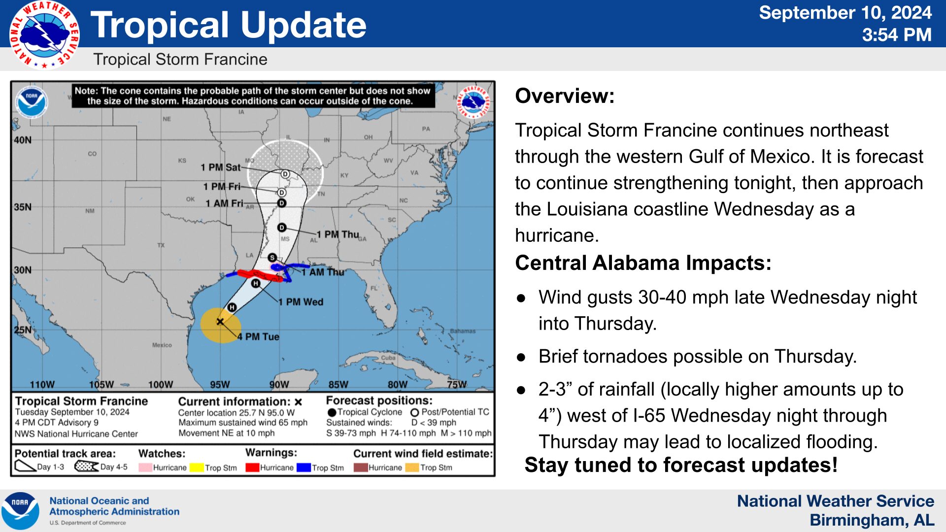
Tropical Storm Francine, located in the western Gulf of Mexico, is forecast to strengthen and make landfall as a hurricane along the Louisiana coastline late Wednesday. Main impacts to Central Alabama will come late Wednesday night into Thursday as it tracks northward through Mississippi. The track has trended eastward resulting in increasing potential for gusty winds.
Threats from Francine are listed below:
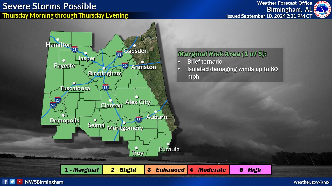
Tornado:
- What: Level 1 out of 5 (Marginal) risk of brief tornadoes.
- Where: All except far eastern portions of Central Alabama.
- When: Thursday morning through Thursday evening.
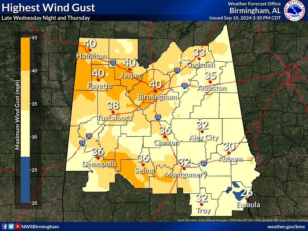
Wind:
- What: Sustained winds 15 to 25 mph with wind gusts of 30 to 40 mph. Locally higher gusts up to 45 mph. Scattered downed trees and power outages.
- Where: Highest winds along and west of I-65.
- When: After midnight Wednesday night through Thursday evening.
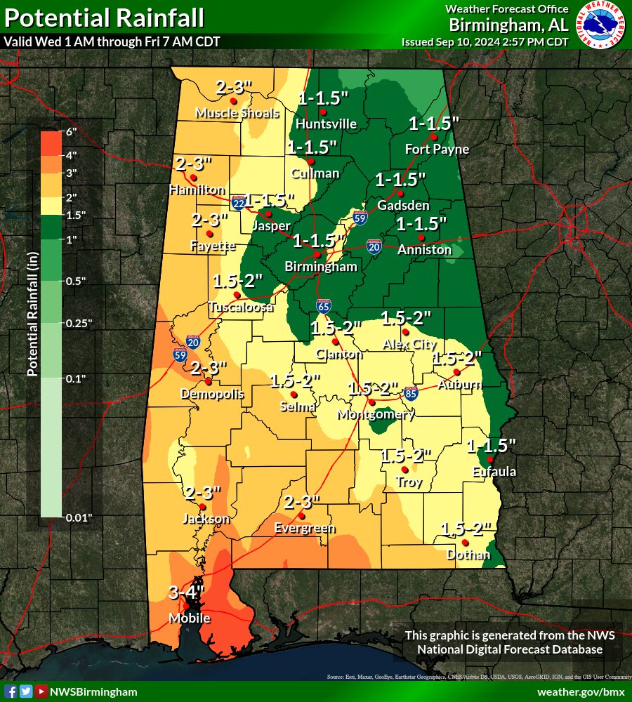
Flooding:
- What: 2-3″ of rainfall with locally higher amounts up to 4″. Isolated flooding mainly in urban and poor drainage areas.
- Where: Greatest threats west of I-65.
- When: Wednesday night through Thursday evening.
FOR THE LATEST WEATHER UPDATES, STAY TUNED TO WEIS RADIO, 100.5 FM, 990 AM, ONLINE AT WEISRADIO.COM AND ON THE WEIS RADIO APP.