
 Strong Thunderstorms Develop Across Cherokee County
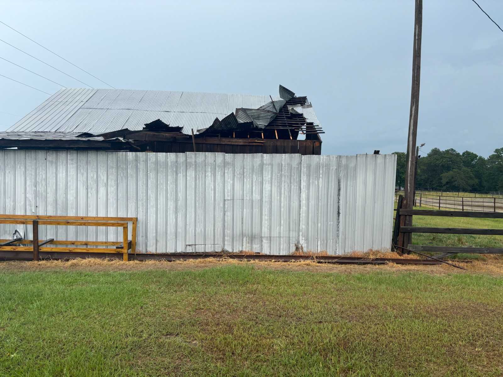
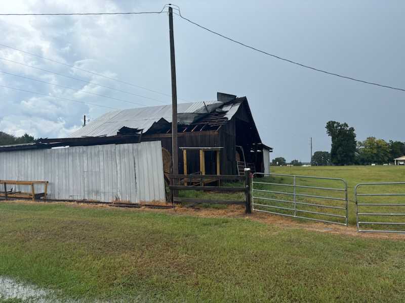
For the second day in a row, strong thunderstorms developed across the eastern portion of Cherokee County, west of Forney – then slowly moved west and northwest across the Key, and Peeks Crossroads, communities before crossing the Lake into Cedar Bluff. Wind damage was experienced just before 3:00pm with metal roofing ripped from a barn on County Road 31 at the intersection of County Road 40.
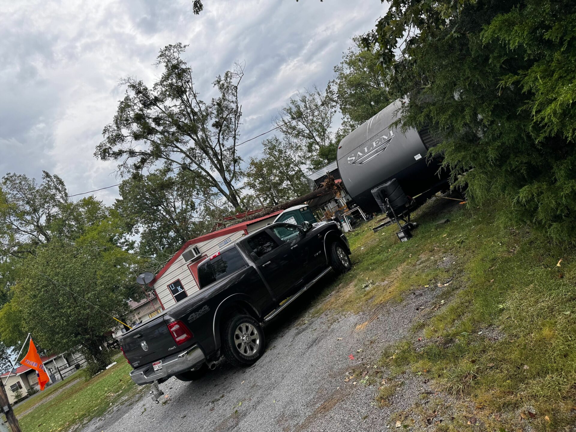
At around 3:00 – damage reports began to come in from the Cedar Bluff area with trees and power lines having been knocked down along Sewell Ferry Road with damage also reported on Hidden Cove Road. There were also reports of roof damage and trees blown onto structures. Scattered reports of trees down across roads come in for about an hour.
On Friday afternoon a similar situation occurred – with storm damage reports of roof damage to 3 structures in the eastern portion of the County.
Fortunately, no injuries were reported with these storms.
The National Weather Service issued strong storm advisories for the areas on both days, and straight line winds up to 50 miles per hour were indicated by radar.
Thundershowers are once again in the forecast for this (Sunday) afternoon, so be “Weather Aware” during the development of the predicted storms.


You must be logged in to post a comment.