

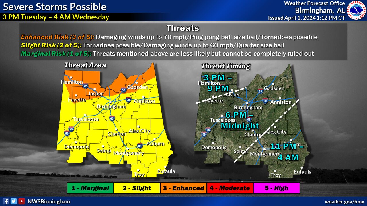
A cold front will move southeast into the area during the day on Tuesday, supporting a risk for showers and thunderstorms with severe storms possible.
Changes from previous forecast: Addition of an Enhanced Risk area across the northern counties. Expansion of the Slight Risk area to the south and east to now cover all of Central Alabama.
Highlights:
Where: All of Central Alabama
When: 3 PM Tuesday in the northwest to 4 AM Wednesday in the southeast
Threats: Damaging winds up to 60-70 mph
- Hail up to ping pong ball size
- A few tornadoes


You must be logged in to post a comment.