A line of thunderstorms will move through Central Alabama late Monday night through Tuesday morning, bringing strong storms, windy conditions, and heavy rainfall to the area.
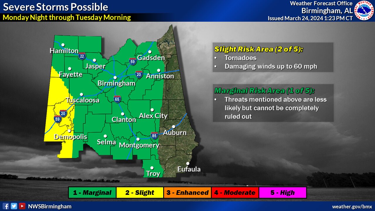
Severe Weather
Where: The western two-thirds of Central AL with the greatest risk in the far southwestern counties
When: Monday night through Tuesday morning
Threats: Tornadoes and Damaging winds up to 60 mph
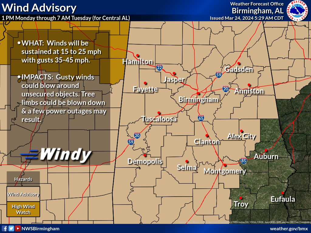
Wind:
Where: Most of Central AL, generally north of I-85
When: 1 PM Monday through 7 AM Tuesday
Threats: Sustained winds 20 to 30 mph with Wind gusts up to 45 mph
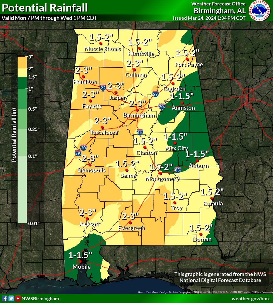
Flooding
Where: All of Central Alabama, especially counties west of I-65
When: 7 PM Monday through Wednesday Morning
Threats: Heavy rainfall leading to localized flooding, especially in urban and/or poor drainage areas.