
Overview:
A complex of showers and storms will develop just northwest of us late tonight and move into our area early tomorrow morning.
Some weakening is expected to occur as it moves in, but it may pose a risk for isolated severe storms and localized flooding. How quickly it progresses southward will determine whether any increase in strength or redevelopment can occur with the heating of the day.
While additional rainfall may occur late Saturday night and into Sunday, amounts are now expected to be light enough to preclude any additional flooding.
Changes from previous forecast:
Marginal risk expanded and timing specified. Flooding threat removed over the weekend.
Highlights:
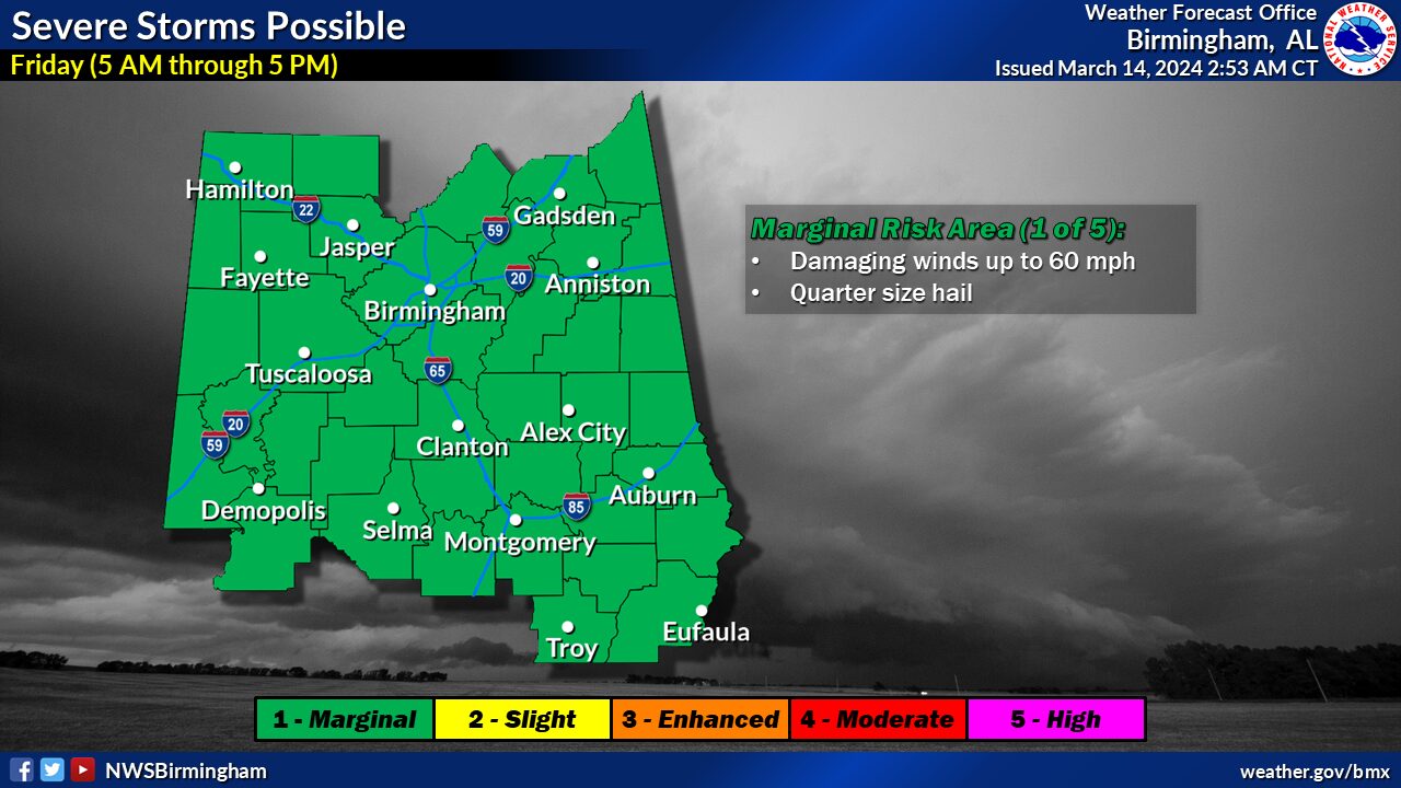
Severe:
* Where:
All of Central Alabama* When:
5 AM to 5 PM on Friday* Threats:
Damaging winds up to 60 mph and quarter size hail
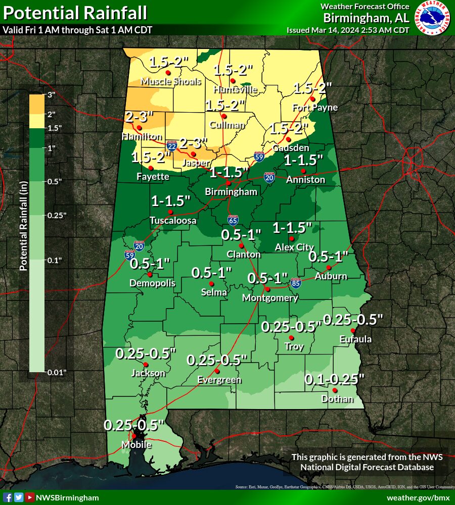
Excessive Rain:
* Where:
All of central Alabama, especially north
* When:
Friday
* Threats:
Minor flooding of low-lying and flood-prone areas


You must be logged in to post a comment.