 Overview:
A cold front will approach the region Friday, stalling over the area over the weekend.
Showers and storms Friday through Friday evening may pose a severe and flooding risk. Additional showers and storms will move through mainly during the Saturday night and Sunday time frame, but rainfall amounts have trended downward with this next wave.
Changes from previous forecast:
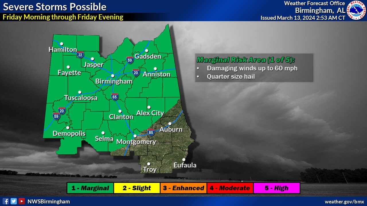
Marginal risk introduced for Friday.
 Highlights:
Severe:
* Where:
Much of Central Alabama, northwest of I-85. Placement of this risk area will depend on impacts of morning showers and storms on the daytime heating.
* When:
Friday morning through Friday evening
* Threats:
Damaging winds up to 60 mph and quarter size hail
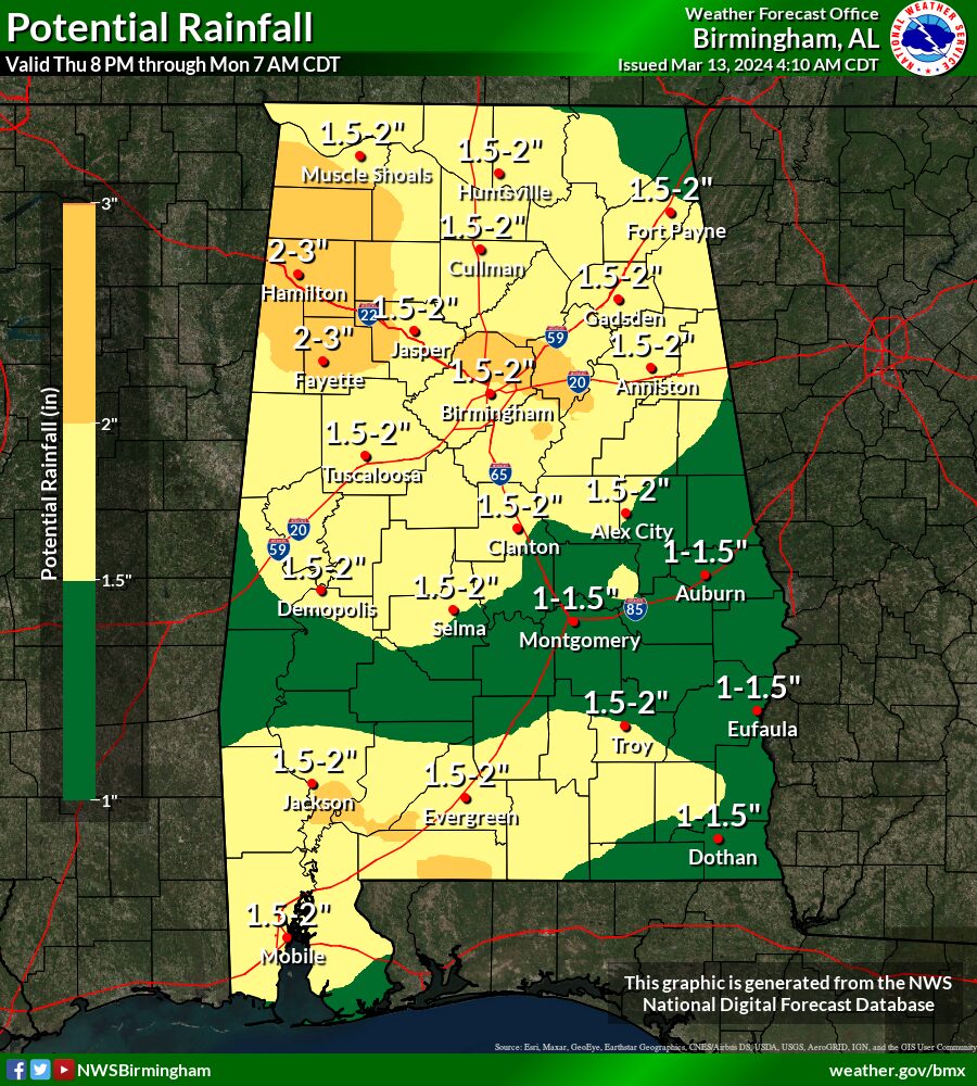
Flooding:
* Where:
All of Central Alabama
* When:
Friday through Sunday
* Threats:
Minor flooding, especially in urban and other poor drainage areas