
Overview:
Wintry precipitation is ALREADY affecting far northwestern portions of Central Alabama; the arctic front is east of the area and the wintry mix is expected to expand southeastward today through tonight, ending in the southeast early tomorrow morning. This will be followed by a period of bitter cold conditions through the middle of the week with another surge of cold air possible this weekend.
Changes from Previous Forecast:
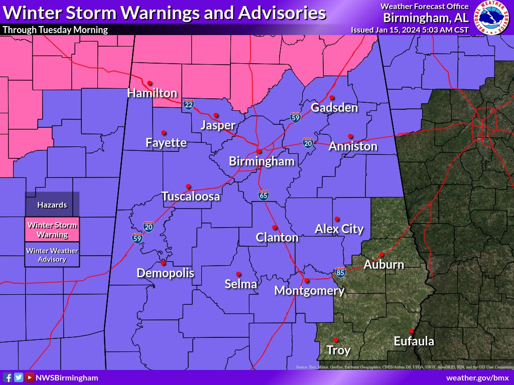
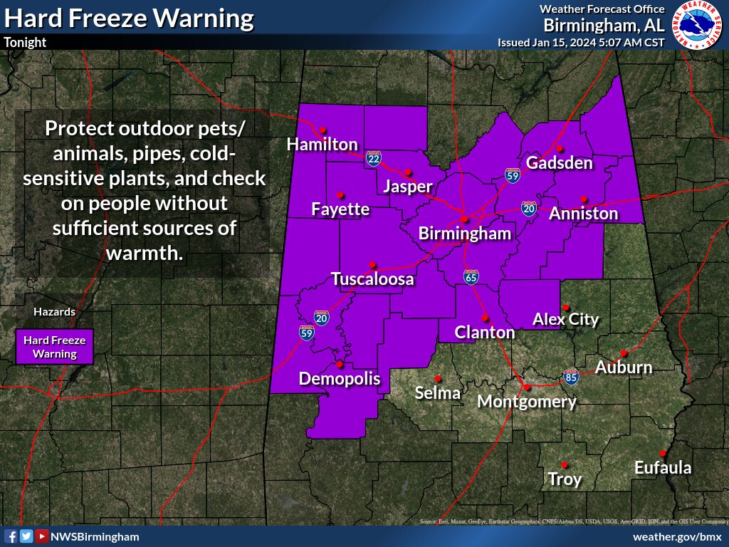
The Winter Weather Advisory was expanded southeast to include a few more counties. A Hard Freeze Warning was issued for the northwestern two-thirds of the area tonight, and all of Central Alabama for Tuesday night. Some minor adjustments were made to the impact timing.
Highlights
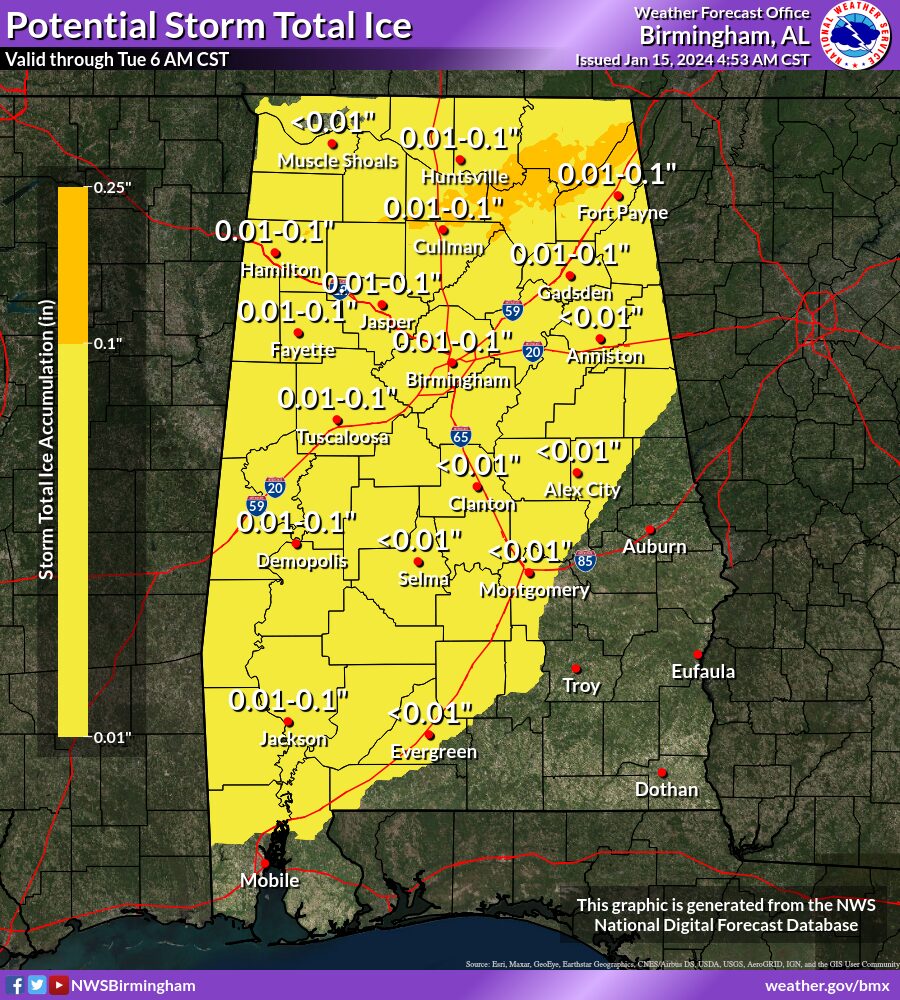
Wintry Precipitation:
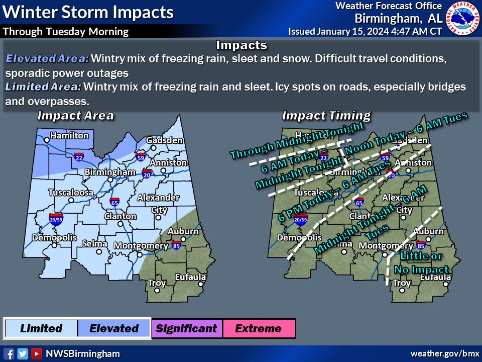
* Where: All but the far southeast part of Central Alabama.
* When: Continuing in the far northwest this morning, and spreading slowly southward today through tonight. Wintry mix will end by early Tuesday morning in the south.
* Threats: A wintry mix of snow, sleet, and freezing rain in the Winter Storm Warning area. Light amounts of sleet or freezing rain in the Winter Weather Advisory area (Even small amounts of freezing rain accumulation can lead to travel impacts).
* Impacts: Potential for slippery roads due to accumulations of ice or snow. Hazardous travel most likely in the far north.
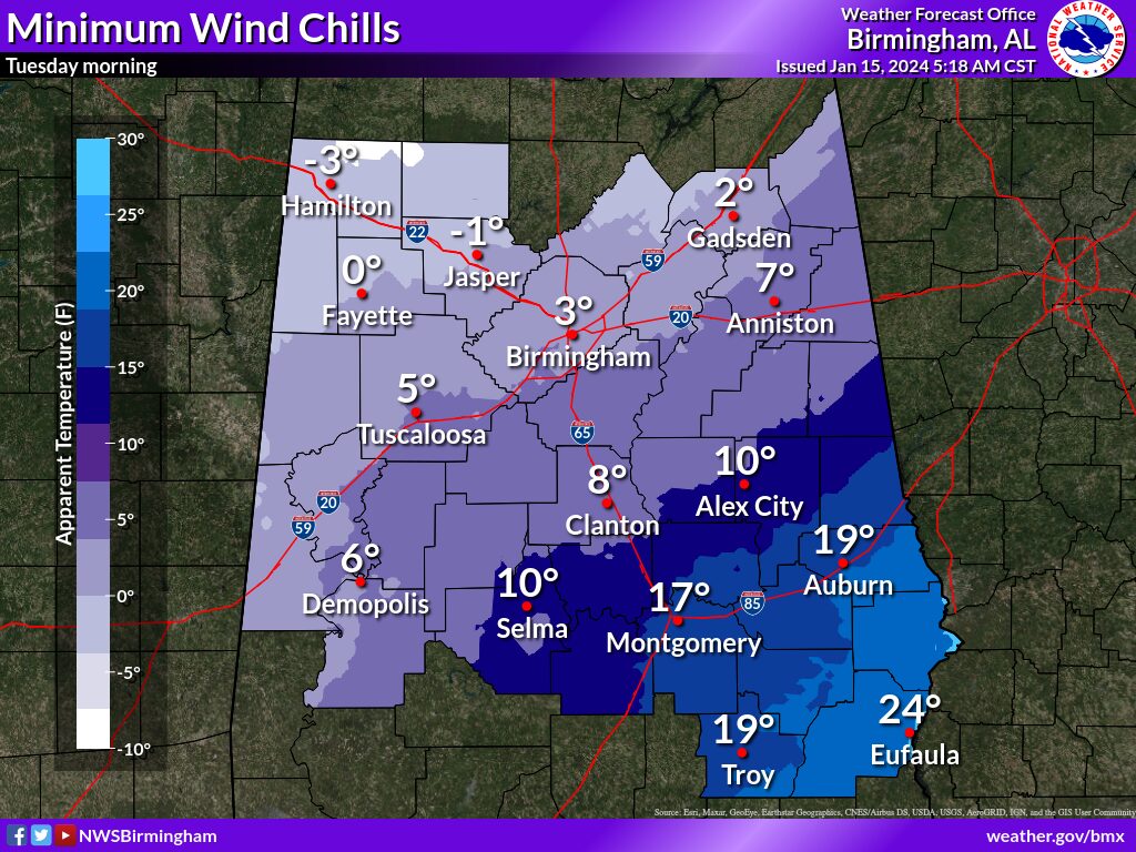
Bitterly Cold Temperatures:
* Where: All of Central Alabama
* When: Monday night through Thursday morning
* Threats: A long-duration cold wave with a hard freeze; wind chill values as low as the single digits below zero.
* Impacts: Exposed, non-insulated pipes will be at risk of bursting; risk of hypothermia for those with prolonged exposure to the cold.

Additional Information: Below-zero wind chill values will be addressed in upcoming forecast updates.


You must be logged in to post a comment.