Overview: The passage of an Arctic front will likely lead to areas of wintry precipitation Monday and Monday night. This will be followed by a period of bitter cold conditions through the middle of the week.
Changes from previous forecast: Winter Storm Watch issued for Marion and Winston Counties, otherwise Minor adjustments to impact areas.
Highlights:
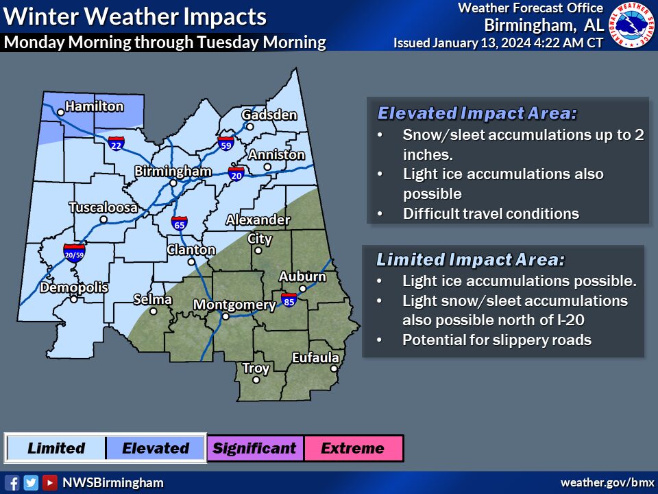
Wintry Precipitation:
* Where: Roughly the northwest half of central Alabama
* When: Monday morning through Tuesday morning
* Threats: Locations receiving either a wintry mix or snow; accumulation potential will be narrowed down as we get closer
* Impacts: Potential for slippery roads due to accumulations of ice or snow
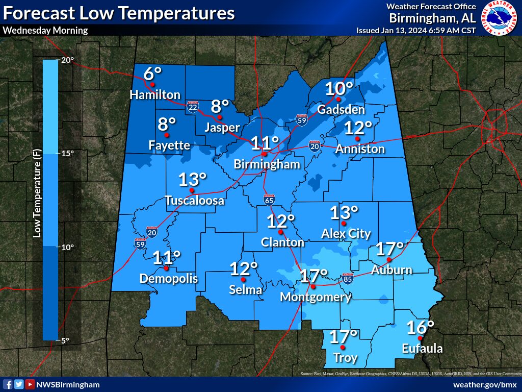
Bitterly Cold Temperatures:
* Where: All of central Alabama
* When: Monday night through Wednesday night
* Threats: A long-duration cold wave is expected with a hard freeze and a wind chill value as low as the single digits above and below zero Tuesday night/Wednesday morning
* Impacts: Exposed, non-insulated pipes will be at risk of bursting, risk of hypothermia for those with prolonged exposure to the cold