
A “cold” front will be moving southeast into the region late this afternoon through tonight. Out ahead of the front, unstable conditions will lead to the development of scattered to perhaps numerous showers and storms. Isolated damaging winds will be possible along with large hail from some of these storms. The front will continue moving through Central Alabama during the day on Tuesday, with additional storms expected to fire up ahead of the front in our southeast counties. Peak heating during the afternoon will help destabilize conditions enough for isolated severe storm development through Tuesday afternoon.
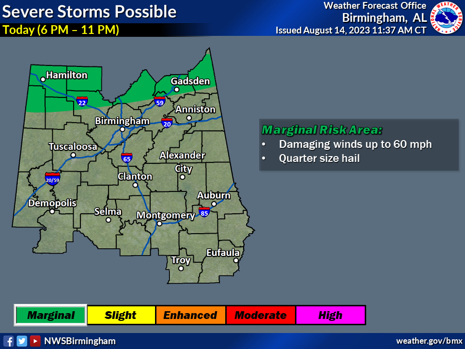
Severe Today & Tonight:
- Where: Far northern counties in Central Alabama
- When: 6pm this afternoon to 11pm tonight
- Threats: Damaging straight-line winds to 60mph and quarter size hail
Severe Tuesday Afternoon:
- Where: Far southeast counties in Central Alabama
- When: 1pm to 6pm
- Threats: Damaging straight-line winds up to 60mph and quarter size hail


You must be logged in to post a comment.