

Overview:
The severe storm train remains throttled up! As of the 5 am hour on Friday, a complex of severe storms is approaching from Jackson, MS. If this complex holds together, it will affect the southwest portion of Central Alabama. The couple models that have somewhat modeled this activity correctly suggest it will begin to weaken near or shortly after crossing the MS/AL state line; however, based on the environment and organization of the line, we have added a severe threat for this morning.
Additional opportunities for severe storms will exist through Sunday night. Locally heavy rain could result in instances of flooding.
Changes from previous forecast:
Added a severe threat for this morning and Saturday.
Highlights:
Today (round 1)
* Where: Southwest portions of Central Alabama
* When: Through 9 am
* Threats: Damaging winds up to 70 mph and large hail
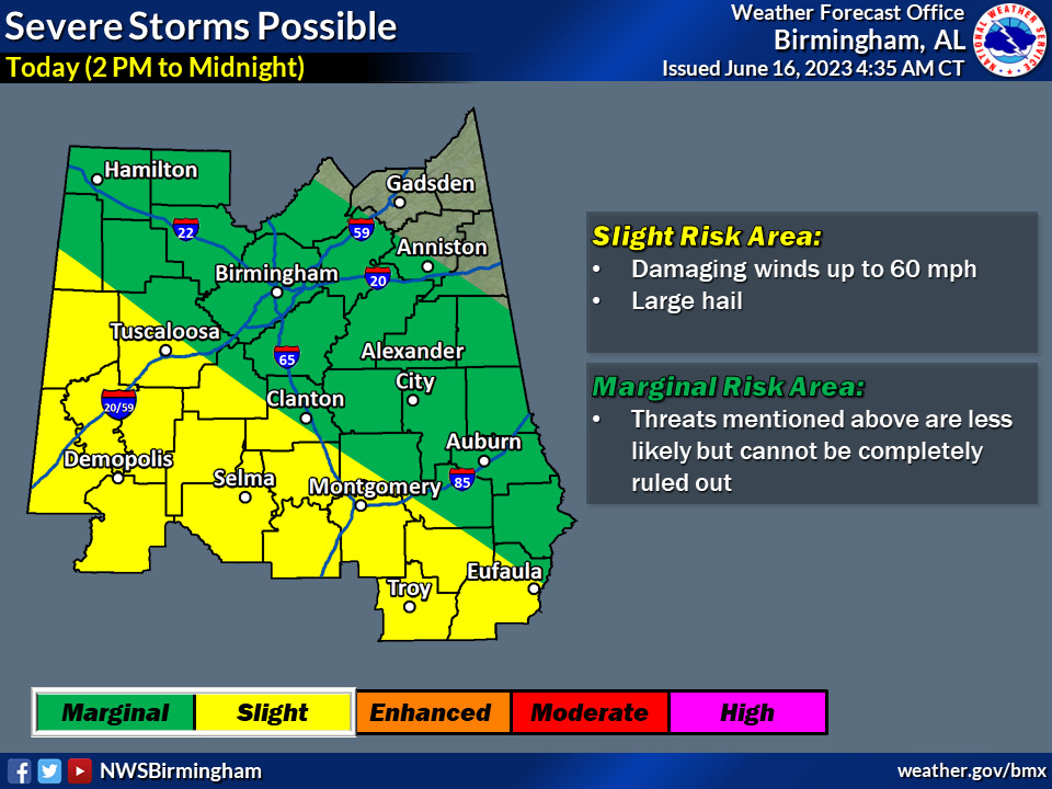
Today (round 2)
* Where: Much of Central Alabama
* When: 2 pm through midnight
* Threats: Damaging winds up to 60 mph and large hail
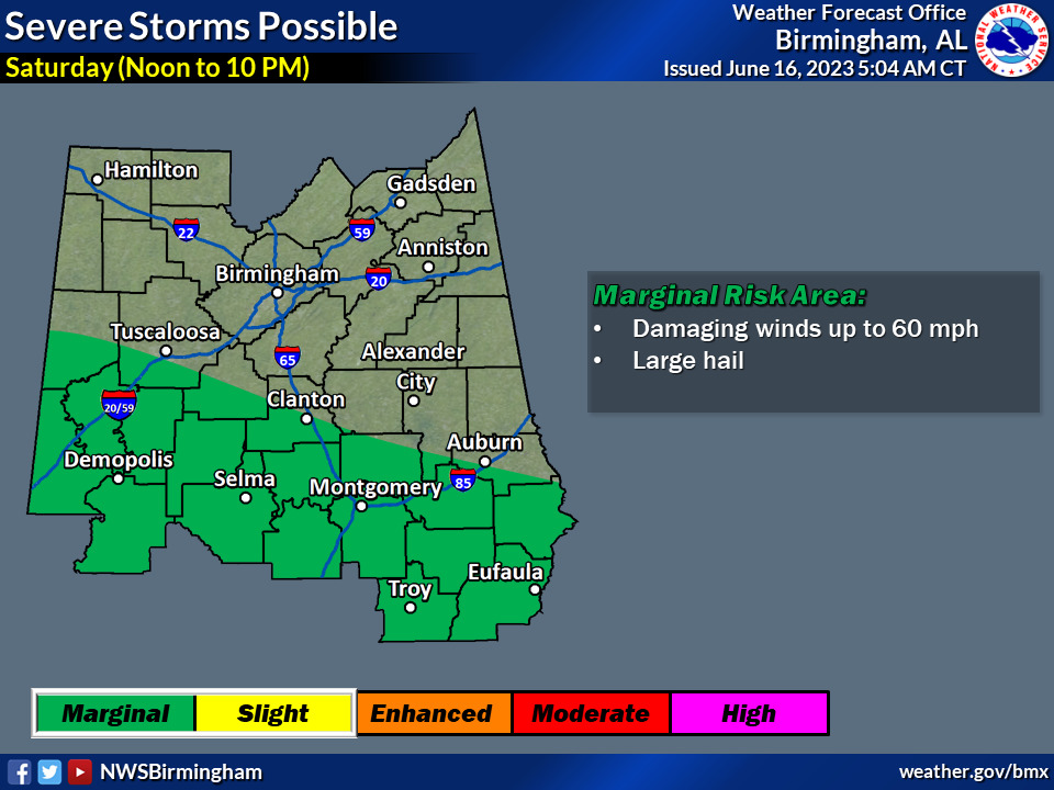
Saturday
* Where: Roughly the southwest half of Central Alabama
* When: Noon to 10 pm
* Threats: Damaging winds up to 60 mph and large hai
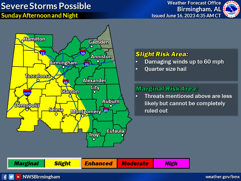
Sunday
* Where: Much of Central Alabama
* When: Afternoon and night
* Threats: Damaging winds up to 60 mph and large hail


You must be logged in to post a comment.