Overview:
Multiple waves of thunderstorms are expected tonight through Thursday evening along a stationary boundary over southern/southwestern Central Alabama. Severe thunderstorms are likely, posing mainly a significant wind and hail threat as well as flash flooding. Additional waves of thunderstorms are possible later this week. A Flash Flood Watch remains in effect until Thursday evening.
Changes from previous forecast:
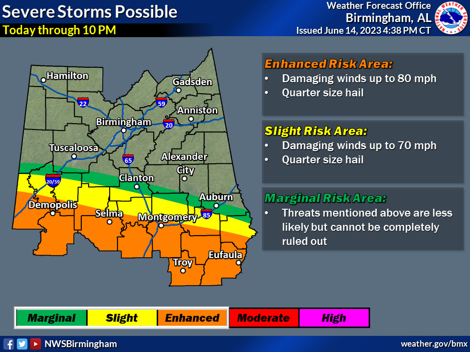
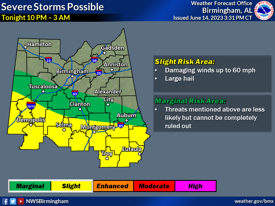
Severe threat graphics for Wednesday evening/overnight have been updated. Two separate graphics have been created for 1) Wednesday evening through 10 PM – and 2) Wednesday night through 3 AM. This accounts for the possibility of a second, less
severe, wave moving through overnight.
Highlights:
Tonight/Thursday morning
* Where: Southern portions of Central Alabama
* When: Round 1 – Through 10 PM tonight; Round 2 – 10 PM through 3 AM
* Threats: Large hail, damaging winds up to 80 mph, and flash flooding
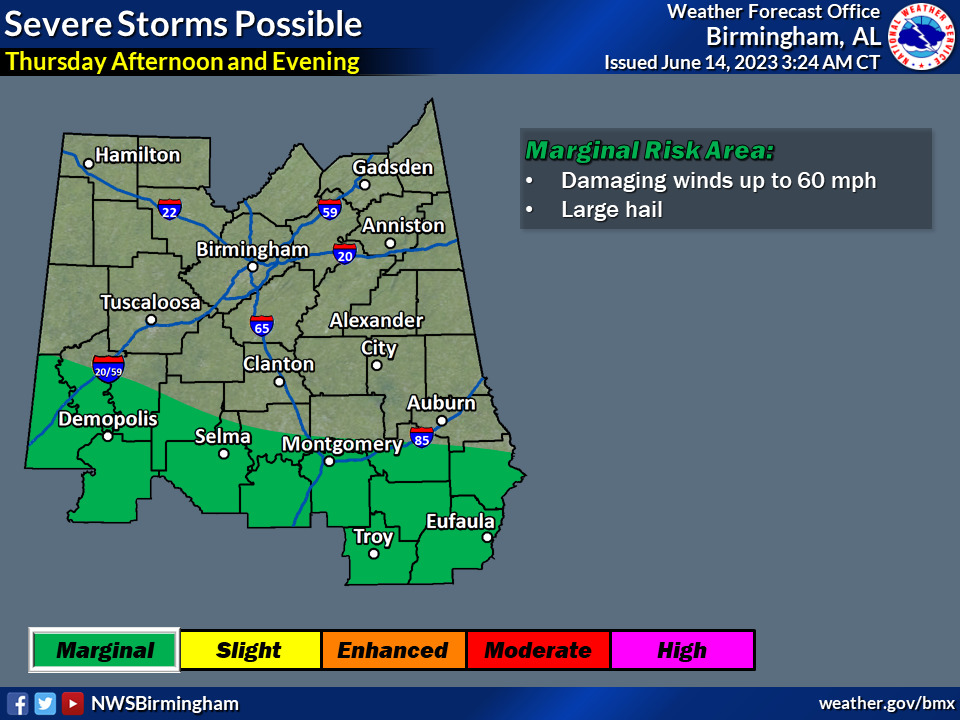
Thursday afternoon
* Where: Southern portions of Central Alabama
* When: Afternoon and evening
* Threats: Large hail, damaging winds up to 60 mph
Friday
* Where: Southern portions of Central Alabama
* When: Afternoon and evening
* Threats: Large hail, damaging winds up to 60 mph


