Overview:
Multiple waves of thunderstorms are expected this morning
through Thursday evening. Severe thunderstorms are likely, and these will pose all severe weather hazards, as well as flash flooding.
Additional waves of thunderstorms are possible later this week.
Changes from previous forecast: Severe weather risk upgraded to a “Moderate” (level 4/5). Friday “Slight Risk” (level 2/5) introduced.
Flash Flood Watch issued.
Highlights:
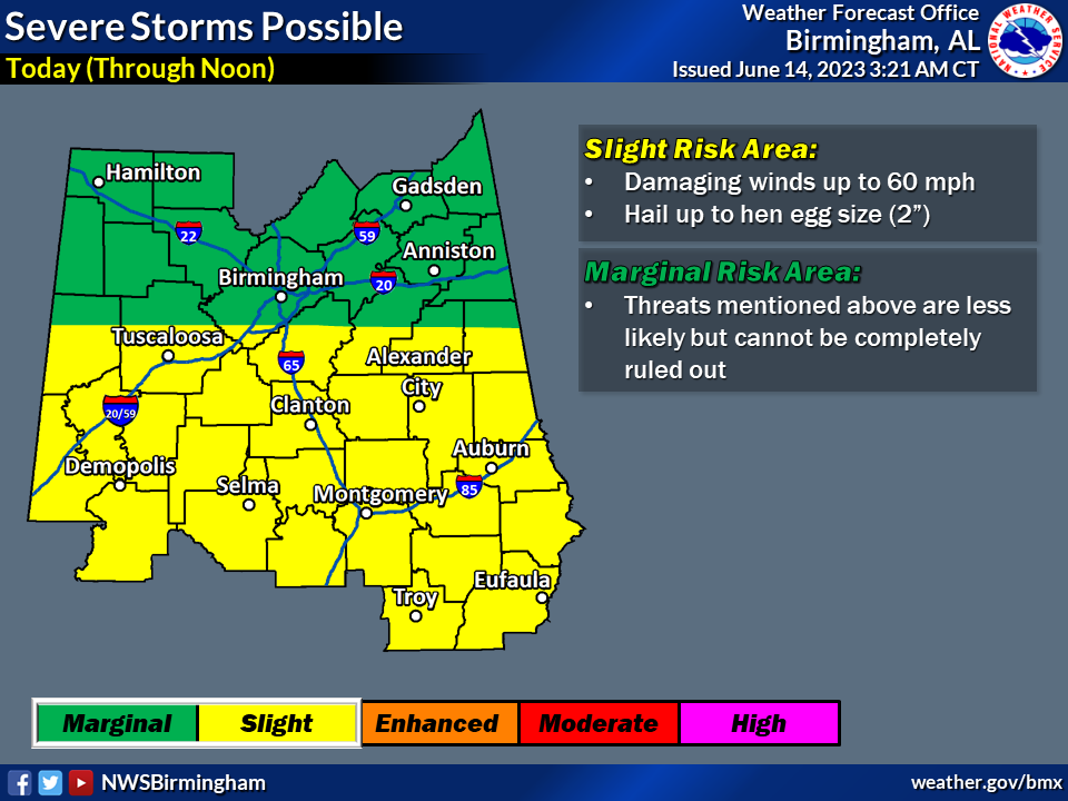
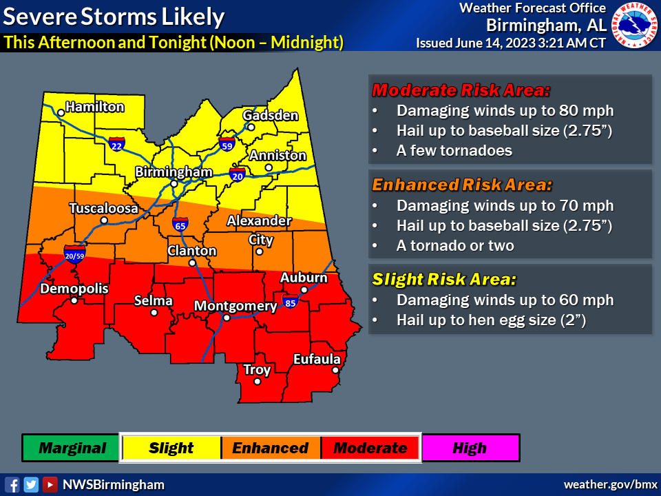
Today
* Where: All of Central Alabama
* When: Multiple rounds during the morning, afternoon, and night
* Threats: Hail up to baseball size (2.75″), damaging winds up to 80 mph, and flash flooding. A tornado cannot be ruled out across southern portions of the area.
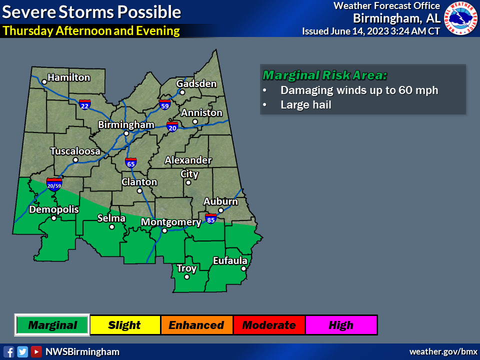
Thursday
* Where: Southern portions of Central Alabama
* When: Afternoon and evening
* Threats: Large hail, damaging winds up to 60 mph

Friday
* Where: Southern portions of Central Alabama
* When: Afternoon and evening
* Threats: Large hail, damaging winds up to 60 mph