Several waves of strong to severe thunderstorms are expected across Central Alabama over the next several days.
Changes from previous forecast: Ended risk for this afternoon and evening (while continuing a risk for the overnight hours).
Highlights:
Overnight
- Where: All of Central Alabama
- When: After midnight
- Threats: Hail up to 1″, damaging winds up to 60 mph, and localized flooding
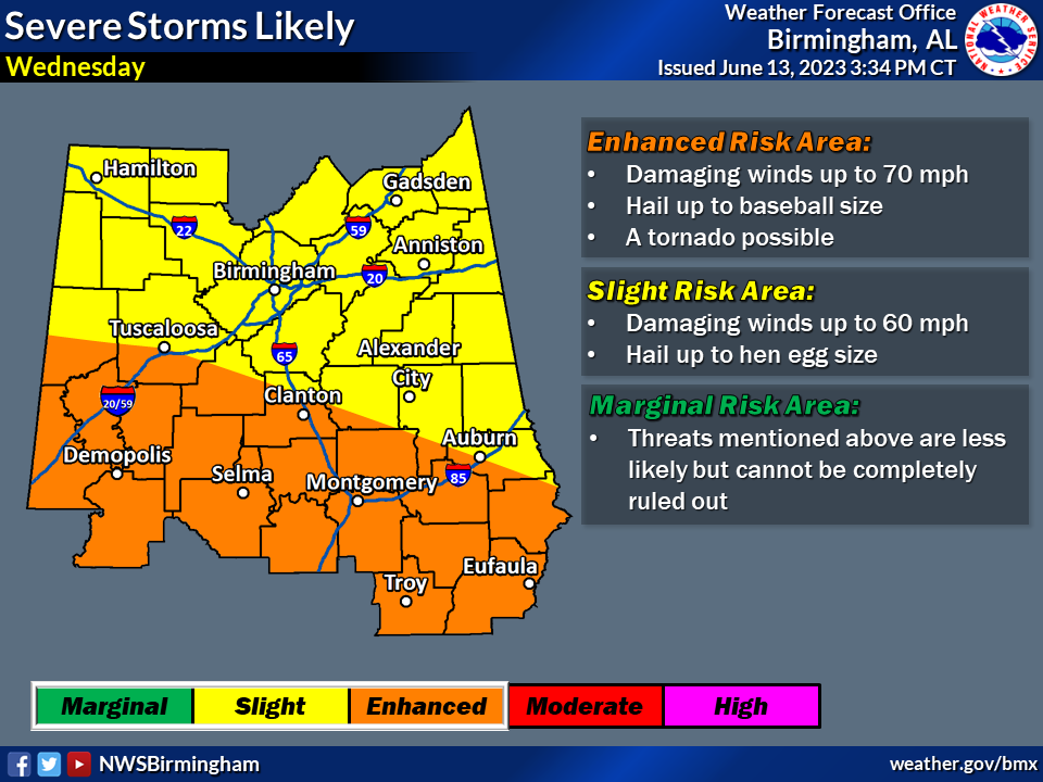
Wednesday
- Where: All of Central Alabama
- When: Multiple rounds during the morning, afternoon, and night
- Threats: Hail up to baseball size (2.75″), damaging winds up to 70 mph, perhaps a tornado, and flooding
Thursday
- Where: Far southern portion of Central Alabama
- When: Afternoon and evening
- Threats: Hail up to 1.5″ and damaging winds up to 60 mph