Overview:
We continue to monitor forecast trends for the anticipated thunderstorms on Sunday.
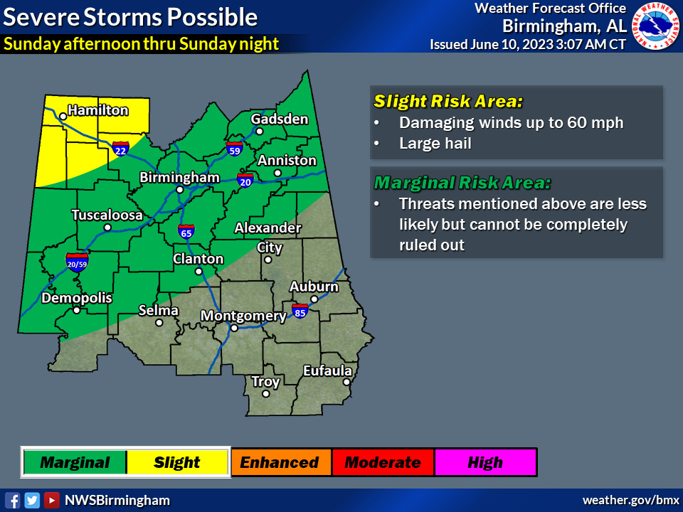
At this time, forecast confidence is increasing for potential impacts during the afternoon and evening. The primary threats are damaging wind gusts and large hail, though locally heavy rainfall is also possible.
Due to the complex nature of the forecast scenario, specific timing and placement remains somewhat unclear. However the absolute best ingredients for severe weather will be during the
afternoon and that could persist into the early overnight hours across much of the area. Stay tuned as the forecast is updated.
Both active and unsettled weather remains forecast into much of next week – with additional disturbances moving across the region. There will be showers and thunderstorms on most days, and we’ll monitor for any additional hazardous weather.
Changes from previous forecast: Northwest portions of Central Alabama increased to a “Slight Risk” (level 2/5). The “Marginal Risk” was expanded south.
Highlights:
Where:
* Much of Central Alabama
When:
* Sunday afternoon through Sunday night
Threats:
* Damaging wind gusts
* Large hail
* Locally heavy rainfall