
A cold front could bring yet another chance for severe storms to part of Alabama starting later tonight.
Tornadoes are not expected to be the main concern this time around, but there will be a chance for damaging winds, hail and heavy rain.
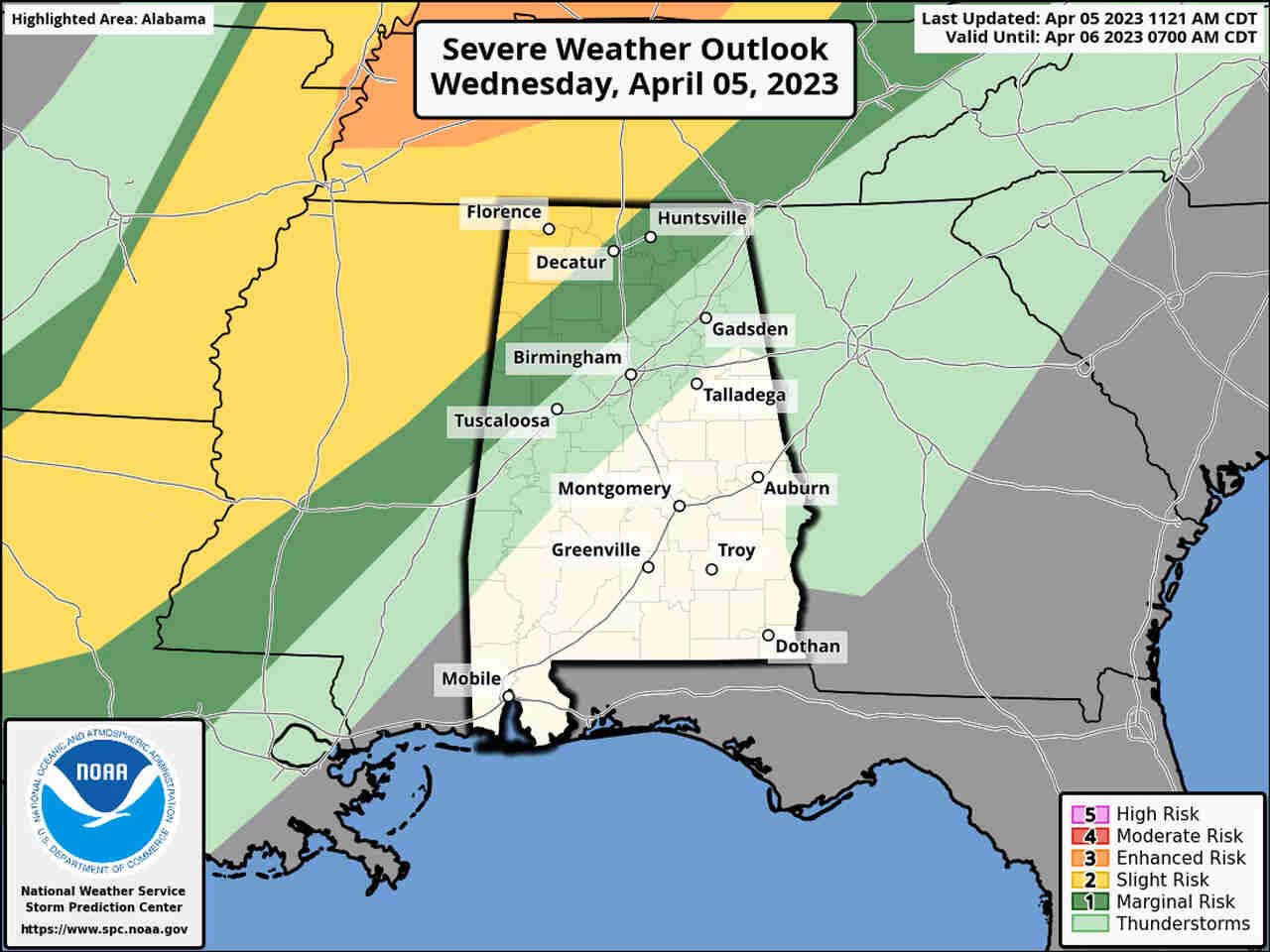
Northwest Alabama will be the place to watch for storms tonight; severe weather isn’t expected for most of the rest of the state.
Rain and storms will be possible statewide, however, as a cold front moves through later tonight and into Thursday.
That front is expected to stall out and hang around, raising rain chances for much of the state through the weekend.
NOAA has a Level 2 out of 5 risk for severe weather for the northwest corner of the state for tonight, which means that scattered severe storms will be possible.
Areas in a strip to the east and south of that have a Level 1 risk and could see isolated severe storms.
Storms could approach northwest Alabama by 7 p.m. tonight and track south and eastward across the state overnight.
It is expected to be another warm day across Alabama, with highs reaching the mid- to upper 80s in many areas.


You must be logged in to post a comment.