
Be on the Lookout for Strong Storms Possible on Sunday; Colder Temps Next Week
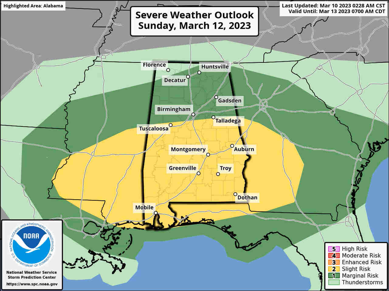
NOAA’s Storm Prediction Center has added a Level 2 out of 5 risk for severe weather for the southern half of Alabama for Sunday, and a Level 1 risk for nearly all the rest of the state (except for the northwest corner).
A Level 2 risk means scattered severe storms will be possible. A Level 1 risk means isolated severe storms will be possible.
The National Weather Service said the strongest storms could have damaging straight-line winds and hail. Forecasters added that the tornado risk is expected to be “non-zero but relatively low compared to the other hazards.”
A few storms will be possible Sunday morning, but the better time for storms will begin during the afternoon hours.
Rain and storms were moving across parts of Alabama on Friday, there is only a Level 1 risk for severe weather for a small area in the southeastern corner of the state. Severe weather isn’t expected in the rest of Alabama today.
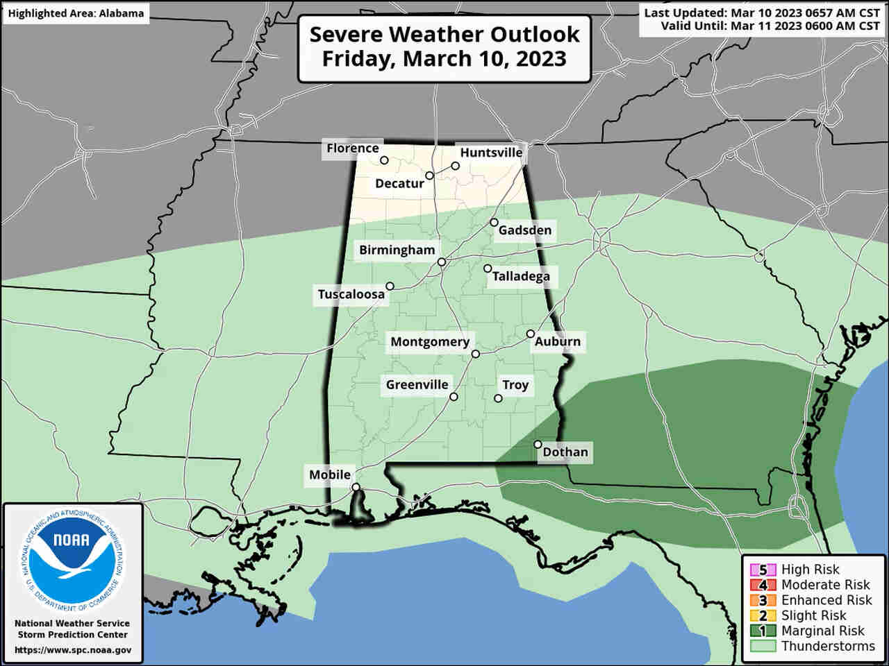
There is a Level 1 risk for severe storms for the area in dark green today. Isolated severe storms will be possible.
That will change on Sunday when a cold front is expected to move into Alabama. Rain and storms are expected to accompany the front, and a few could reach severe limits.
The front is expected to move out of the state later on Sunday, and much cooler air is expected to settle over the state in its wake.
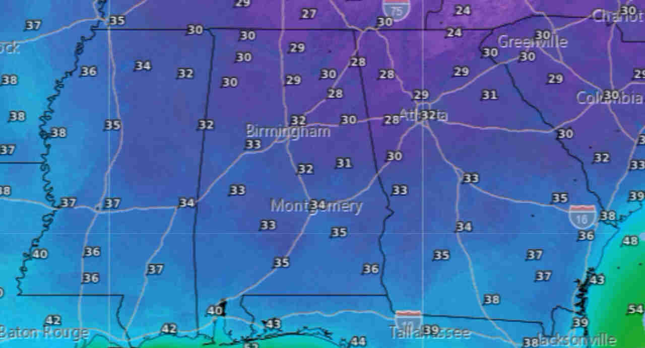
In fact, it could be cold enough that freezing temperatures and frost will be possible for the northern part of the state Monday and Tuesday nights.
Low temperatures on Monday night into Tuesday morning could fall below freezing in north and north central Alabama, with upper 30s and low 40s expected for the rest of the state.
Tuesday night could be the colder of the two, the weather service said, with temperatures falling into the upper 20s in north Alabama and mid-30s possible down into south Alabama.
Tuesday night could bring sub-freezing temperatures to parts of Alabama.
(AL.COM/NWS)


You must be logged in to post a comment.