
 BULLETIN – IMMEDIATE BROADCAST REQUESTED
Severe Thunderstorm Warning
National Weather Service Birmingham AL
1257 PM CST Fri Mar 3 2023
The National Weather Service in Birmingham has issued a
* Severe Thunderstorm Warning for…
Northern Calhoun County in east central Alabama…
Northeastern Cleburne County in east central Alabama…
Cherokee County in northeastern Alabama…
* Until 215 PM CST.
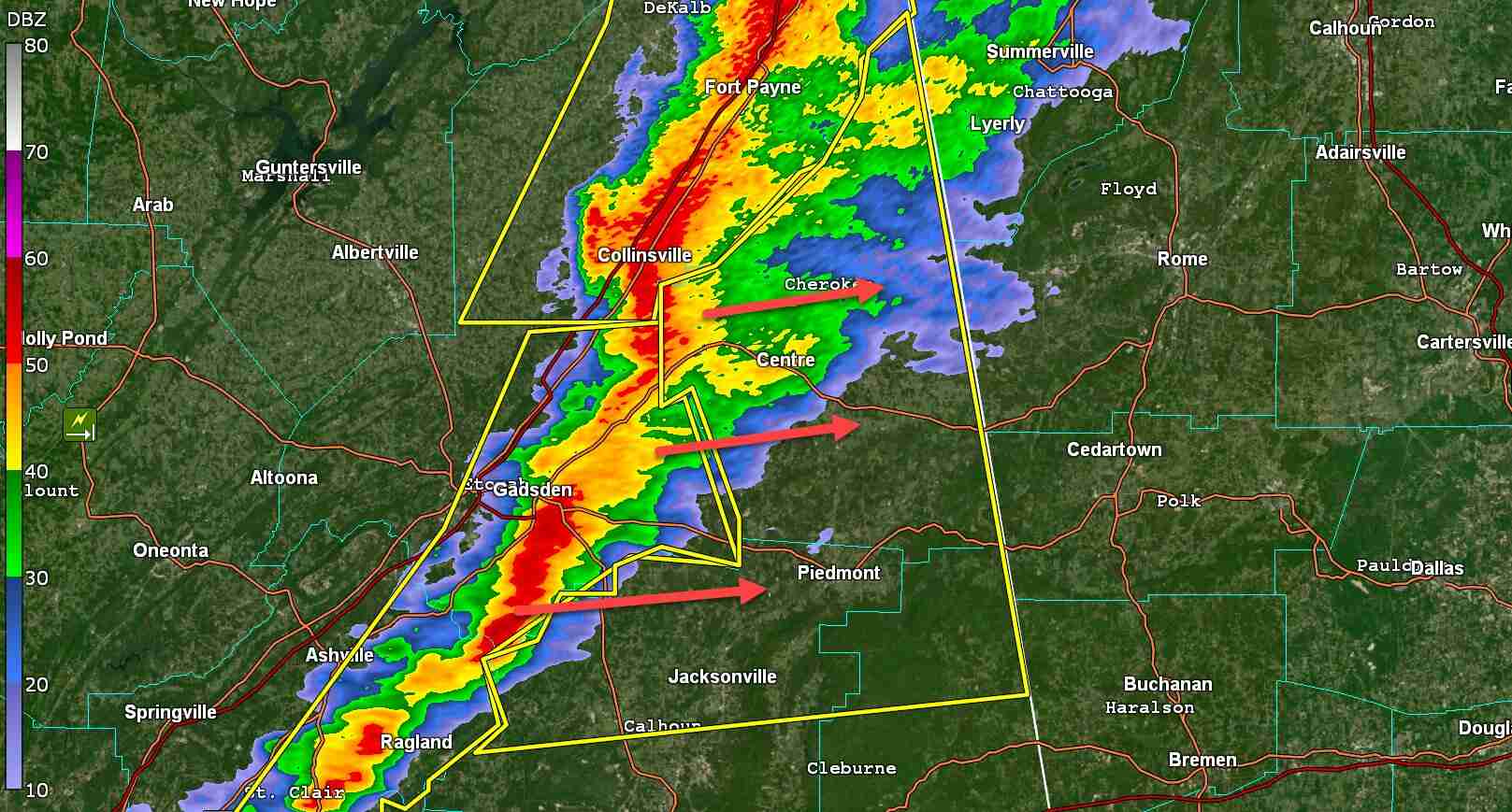
* At 1257 PM CST, severe thunderstorms were located along a line extending from near Crossville to near Gadsden Mall to near Ragland, moving northeast at 60 mph.
HAZARD…60 mph wind gusts.
SOURCE…Radar indicated.
IMPACT…Expect damage to roofs, siding, and trees.
* Locations impacted include…
Jacksonville, Piedmont, Centre, Cedar Bluff, Little River Canyon
National Preserve, Forney, Centre Municipal Airport, Glencoe,
Weaver, Ohatchee, Leesburg, Sand Rock, Gaylesville, Tennala,
Cherokee Rock Village, Pleasant Gap, Cornwall Furnace Park,
Blanche, Eastern Weiss Lake and Alexandria.
PRECAUTIONARY/PREPAREDNESS ACTIONS
A Tornado Watch remains in effect until 400 PM CST for central, northeastern and east central Alabama
For your protection move to an interior room on the lowest floor of a building.


You must be logged in to post a comment.