Overview: A broken line of showers and storms is expected to quickly move across Central Alabama on Friday with a severe threat. Aside from storms, it will be a windy day with gusts upwards of 50 mph with related impacts.
Highlights:
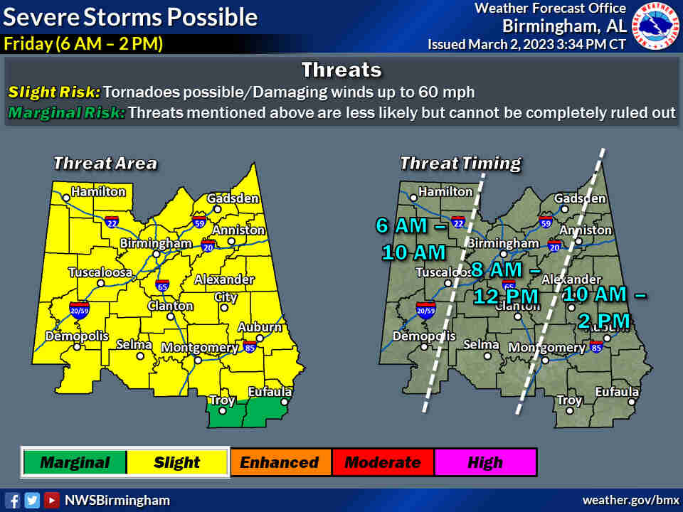
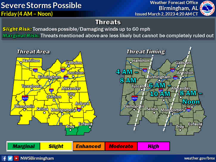
Severe:
* Where: All of Central Alabama * When: Friday 6 am to 2 pm * Threats: Tornadoes and damaging winds up to 60 mph
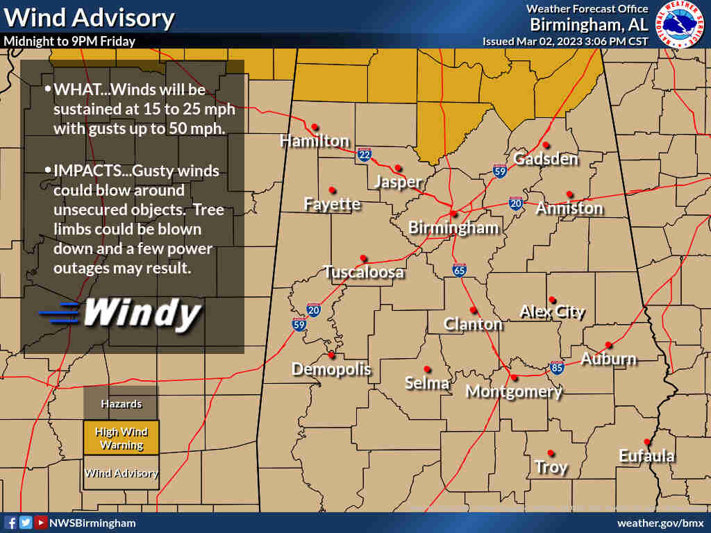
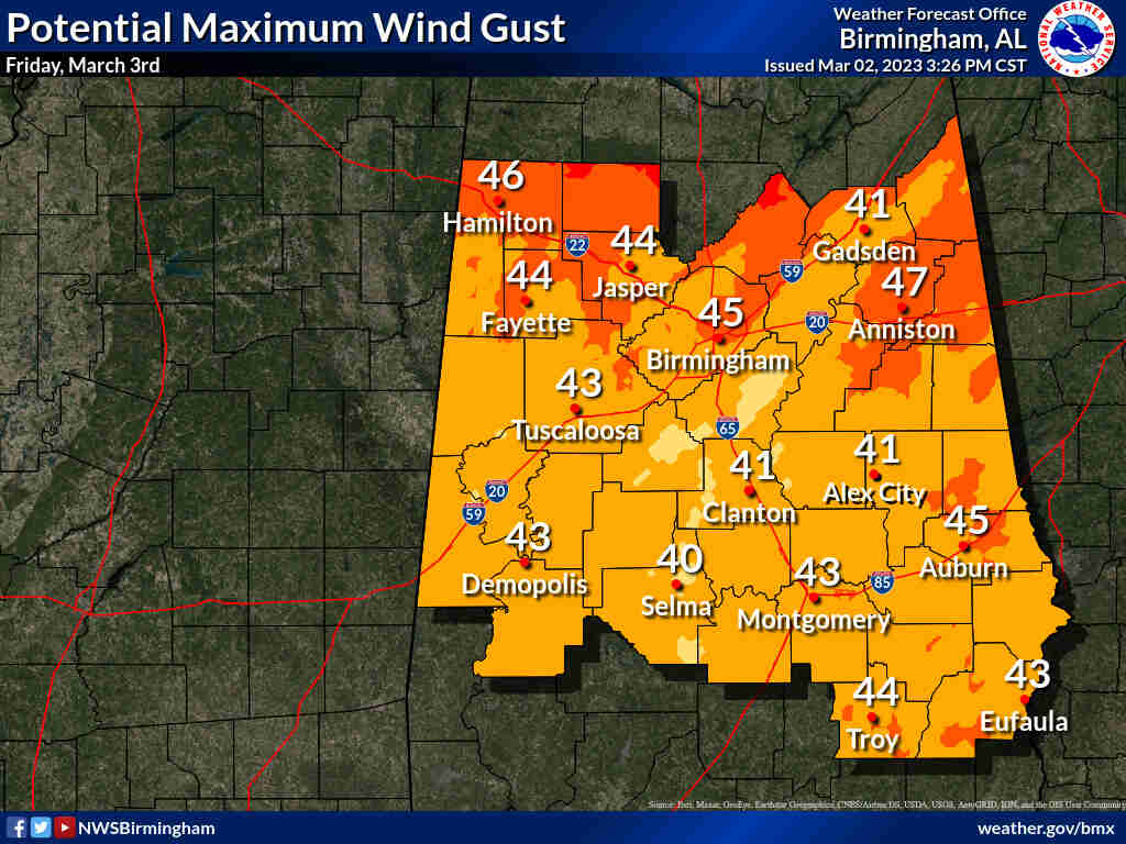
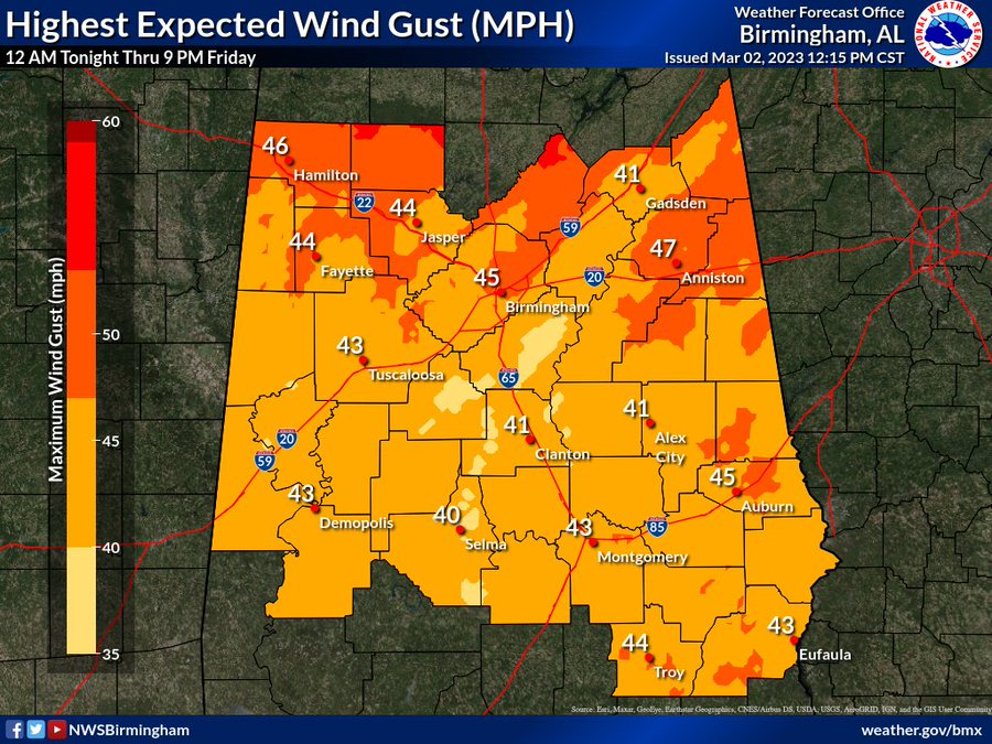
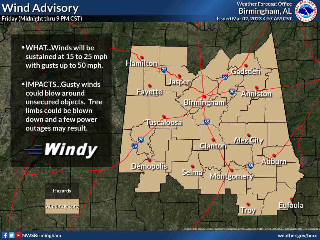
Non-thunderstorm winds:
* Where: All of Central Alabama * When: 12 am Friday to 9 pm Friday * Threats: Downed trees/limbs and power outages due to gusts upwards of 50 mph
Go ahead and close your patio umbrella and secure any other loose outdoor items because it will become very windy across the area tonight thru tomorrow! We may see non-tstorm wind gusts as high as 50 mph! This could lead to sporadic tree fall and intermittent power outages. #alwx
(10am) From the NWS earlier today
Overview:
A cold front will rapidly pass through the area tomorrow morning with a line of showers and thunderstorms. This system will produce a substantial increase in non-thunderstorm wind gusts in addition to a risk for severe storms.Changes from previous forecast:
Minor adjustments to the Slight risk area.Highlights: Where: * All of Central Alabama. When:
We use cookies on our website to give you the most relevant experience by remembering your preferences and repeat visits. By clicking “Accept”, you consent to the use of ALL the cookies.
This website uses cookies to improve your experience while you navigate through the website. Out of these, the cookies that are categorized as necessary are stored on your browser as they are essential for the working of basic functionalities of the website. We also use third-party cookies that help us analyze and understand how you use this website. These cookies will be stored in your browser only with your consent. You also have the option to opt-out of these cookies. But opting out of some of these cookies may affect your browsing experience.
Necessary cookies are absolutely essential for the website to function properly. These cookies ensure basic functionalities and security features of the website, anonymously.
Cookie
Duration
Description
cookielawinfo-checkbox-analytics
11 months
This cookie is set by GDPR Cookie Consent plugin. The cookie is used to store the user consent for the cookies in the category "Analytics".
cookielawinfo-checkbox-functional
11 months
The cookie is set by GDPR cookie consent to record the user consent for the cookies in the category "Functional".
cookielawinfo-checkbox-necessary
11 months
This cookie is set by GDPR Cookie Consent plugin. The cookies is used to store the user consent for the cookies in the category "Necessary".
cookielawinfo-checkbox-others
11 months
This cookie is set by GDPR Cookie Consent plugin. The cookie is used to store the user consent for the cookies in the category "Other.
cookielawinfo-checkbox-performance
11 months
This cookie is set by GDPR Cookie Consent plugin. The cookie is used to store the user consent for the cookies in the category "Performance".
viewed_cookie_policy
11 months
The cookie is set by the GDPR Cookie Consent plugin and is used to store whether or not user has consented to the use of cookies. It does not store any personal data.
Functional cookies help to perform certain functionalities like sharing the content of the website on social media platforms, collect feedbacks, and other third-party features.
Performance cookies are used to understand and analyze the key performance indexes of the website which helps in delivering a better user experience for the visitors.
Analytical cookies are used to understand how visitors interact with the website. These cookies help provide information on metrics the number of visitors, bounce rate, traffic source, etc.
Advertisement cookies are used to provide visitors with relevant ads and marketing campaigns. These cookies track visitors across websites and collect information to provide customized ads.


You must be logged in to post a comment.