
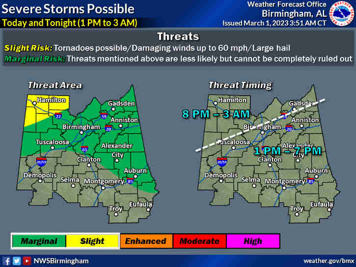
The National Weather Service says we could see some strong thunderstorms on this Wednesday afternoon and evening. While the threat has decreased some there is still a possibility we could experience strong straight line winds associated with thunderstorms.
There is a marginal risk for the north central Alabama area with the threat of large hail and damaging wind gusts to 60 mph.
The greatest threat is along and north of Interstate 20 from 1 pm to 11 pm.
A fast moving weather system will be moving across the state early Friday morning into the afternoon (4am to 1pm). The National Weather Service says there is a “Slight Risk”, which is a 2 of 5 chance, for the development of strong thunderstorms.
All of Central Alabama will have the threat of damaging wind gusts to 60 mph and tornadoes during this time.
Non-thunderstorm wind gusts up to 40 mph are also possible from Thursday night through Friday afternoon. If the system slows some, the time frame could be later on Friday.
Pay Close Attention To Developing Weather During This Time!


You must be logged in to post a comment.