
*****UPDATE: The Tornado Watch for DeKalkb, Jackson, and Marshall counties has expired, but continues for Calhoun, Cherokee, Cleburne, Etowah, and the rest of our coverage area until 8pm.*****
The Tornado Watch issued by the National Weather Service includes all of the WEIS Radio coverage area.
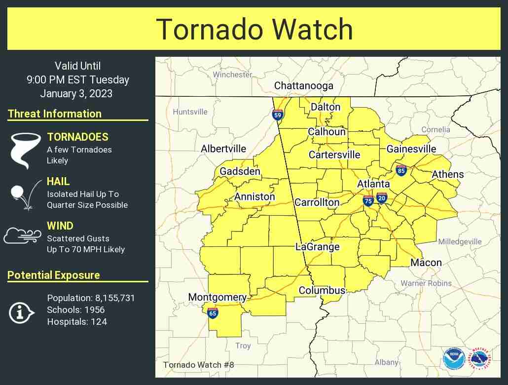
TORNADO WATCH OUTLINE UPDATE FOR WT 8
NWS STORM PREDICTION CENTER NORMAN OK
155 PM EST TUE JAN 3 2023

TORNADO WATCH 8 IS IN EFFECT UNTIL 900 PM EST FOR THE
 FOLLOWING LOCATIONS

ALC015-017-019-027-029-037-051-055-081-087-101-111-115-121-123-
040200-
/O.NEW.KWNS.TO.A.0008.230103T1855Z-230104T0200Z/

AL
.    ALABAMA COUNTIES INCLUDED ARE

CALHOUN              CHAMBERS            CHEROKEE
CLAY                 CLEBURNE            COOSA
ELMORE               ETOWAH              LEE
MACON                MONTGOMERY          RANDOLPH
ST. CLAIR            TALLADEGA           TALLAPOOSA
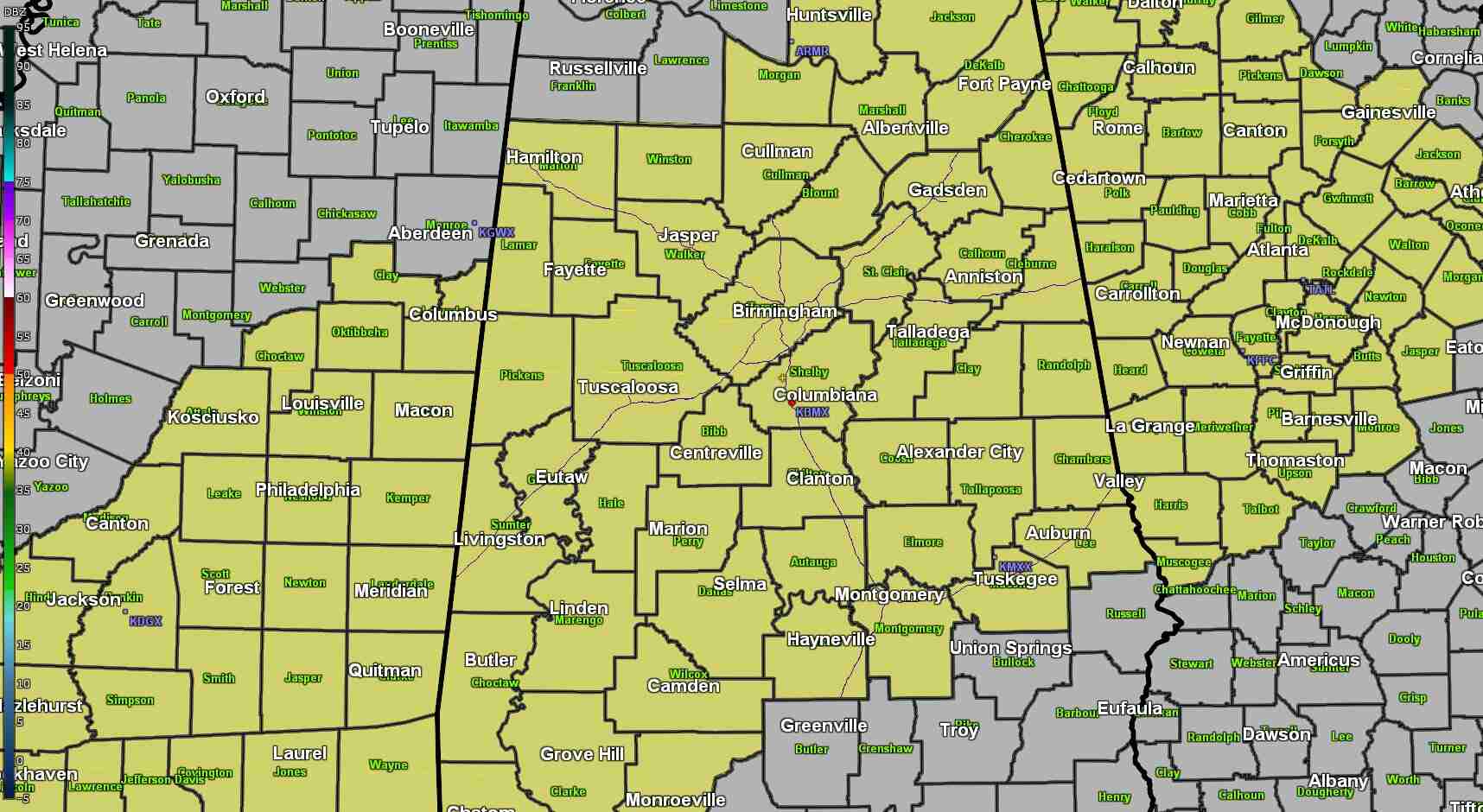
WATCH COUNTY NOTIFICATION FOR WATCH 7
NATIONAL WEATHER SERVICE HUNTSVILLE AL
1225 PM CST TUE JAN 3 2023

ALC049-071-095-032300-
/O.EXA.KHUN.TO.A.0007.000000T0000Z-230103T2300Z/

THE NATIONAL WEATHER SERVICE HAS EXTENDED TORNADO WATCH 7 TO
INCLUDE THE FOLLOWING AREAS UNTIL 5 PM CST THIS AFTERNOON

IN ALABAMA THIS WATCH INCLUDES 3 COUNTIES

IN NORTHEAST ALABAMA

DEKALB                JACKSON               MARSHALL

THIS INCLUDES THE CITIES OF ALBERTVILLE, ARAB, BOAZ, FORT PAYNE,
GUNTERSVILLE, RAINSVILLE, AND SCOTTSBORO.nwd, tornado watch, dekalb county
From the National Weather Servie: “Counties east of Interstate 65 have been added to the Tornado Watch, valid through 8 pm this evening. Counties along and west of Interstate 65 continue through 5 pm. This is for ROUND ONE of storms. We will clear west to east as the initial round clears.”


You must be logged in to post a comment.