
 The risk for severe weather in Alabama on Wednesday has increased.
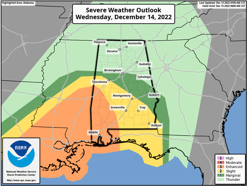
NOAA’s Storm Prediction Center early Tuesday added a Level 3 out of 5 — or “enhanced” — severe weather risk for southwest Alabama and expanded the threat for strong storms farther into the state. A Level 3 risk means numerous severe storms will be possible. The rest of south Alabama and part of central Alabama has a Level 2 risk, which means scattered severe storms will be possible. A Level 1 risk of severe weather has been expanded as far north as Birmingham and Talladega. A Level 1 risk means isolated severe storms will be possible.
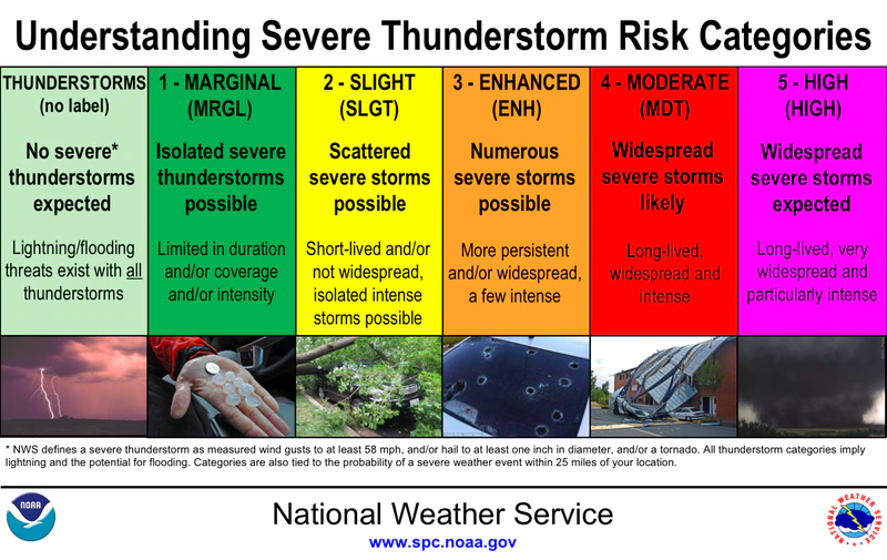
Here is how the Storm Prediction Center ranks severe weather risks.
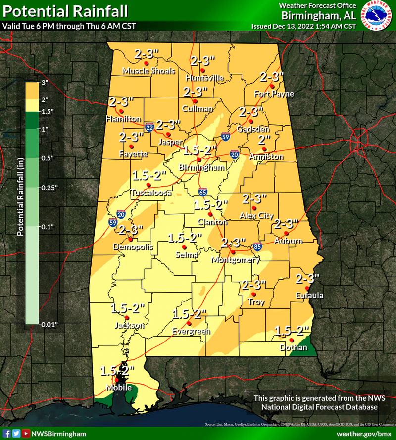
The prime time for severe weather will be from Wednesday afternoon into early Thursday morning. Tornadoes, damaging winds and heavy rain will all be possible in the severe weather risk areas. Heavy rain is expected statewide, and the National Weather Service says up to 4 inches could be possible in some areas. That much rain, combined with recent soggy weather around the state, could cause flooding issues on Wednesday and early Thursday, especially in areas that that receive the heaviest rain. A flood watch could be issued for some areas later today.
The weather service will be watching for a squall line of storms to develop to the west of Alabama and push into the state on Wednesday afternoon. However, forecasters also said some individual storms could develop out ahead of the main line earlier in the day on Wednesday. Those storms could generate tornadoes as well as damaging winds.
Tornadoes and high winds will also be possible with the main line of storms. Showers and storms will be possible for parts of Alabama as soon as tonight but severe weather isn’t expected today, according to the weather service.
Cooler weather is expected to follow Wednesday’s storms, and by the weekend temperatures are expected to be much below average, according to the weather service. Another storm system is expected to develop over the weekend that could — could — bring some more precipitation to Alabama. Forecasters said temperatures in south Alabama, the most likely area to see precipitation from the weekend system, would be above freezing on Saturday and Sunday nights. Forecasters said they will continue to monitor trends in case that changes and wintry precipitation becomes a possibility.
(Compiled Sources)


You must be logged in to post a comment.