A strong storm system is expected to move across the Southeastern US today through Wednesday morning, with a threat for severe storms and localized flooding. Breezy conditions are also expected outside of the thunderstorms, with gusts upwards of 30mph this afternoon through the overnight hours tonight. Localized flooding may also become a concern as storms track over the same areas through Wednesday morning before drier air moves in during the day on Wednesday.
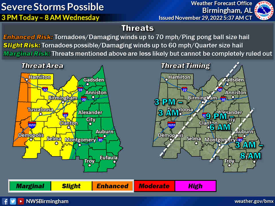
The Enhanced Risk area has been expanded once again and now includes all of our far western Central Alabama Counties along the Mississippi state line. All other risk areas remain the same. Timing has been adjusted slightly, now beginning an hour earlier in the west. Minor timing adjustments have been made elsewhere. Confidence is increasing in the chance of heavy rainfall, and forecast rainfall amounts have been adjusted upward as a result.
Where:
- All of Central Alabama
When:
- 3pm Today through 8am Wednesday morning
Threats:
- Tornadoes
- Damaging winds up to 70mph
- Hail up to ping pong ball size
- Heavy rainfall may result in localized flooding
This is the latest weather update provided by the National Weather Service in Birmingham. Be sure you can have access to severe weather information during this time period. Stay tuned to WEIS Radio for the latest information from the National Weather Service. You can tune to 100.5 FM, 990 AM, listen online at www.weisradio.com and on the WEIS Radio App from your phones.