
Heavy, heavy rainfall began overnight Saturday in Cherokee County and continued to come down for most of the morning on Sunday. Over that time, the National Weather Service issued a number of watches and warnings regarding travel, while local media and first responders along with the Cherokee County EMA officials kept a running list of areas to avoid.
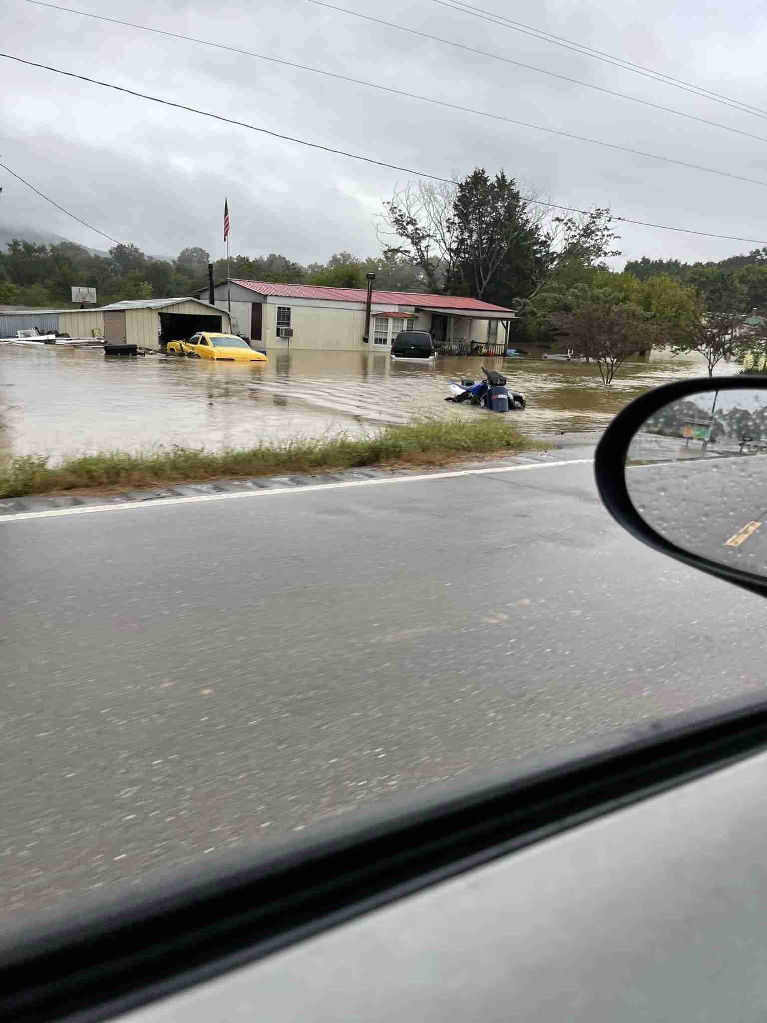
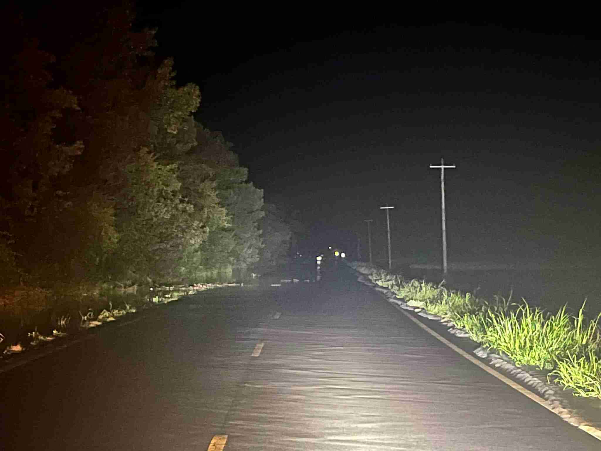
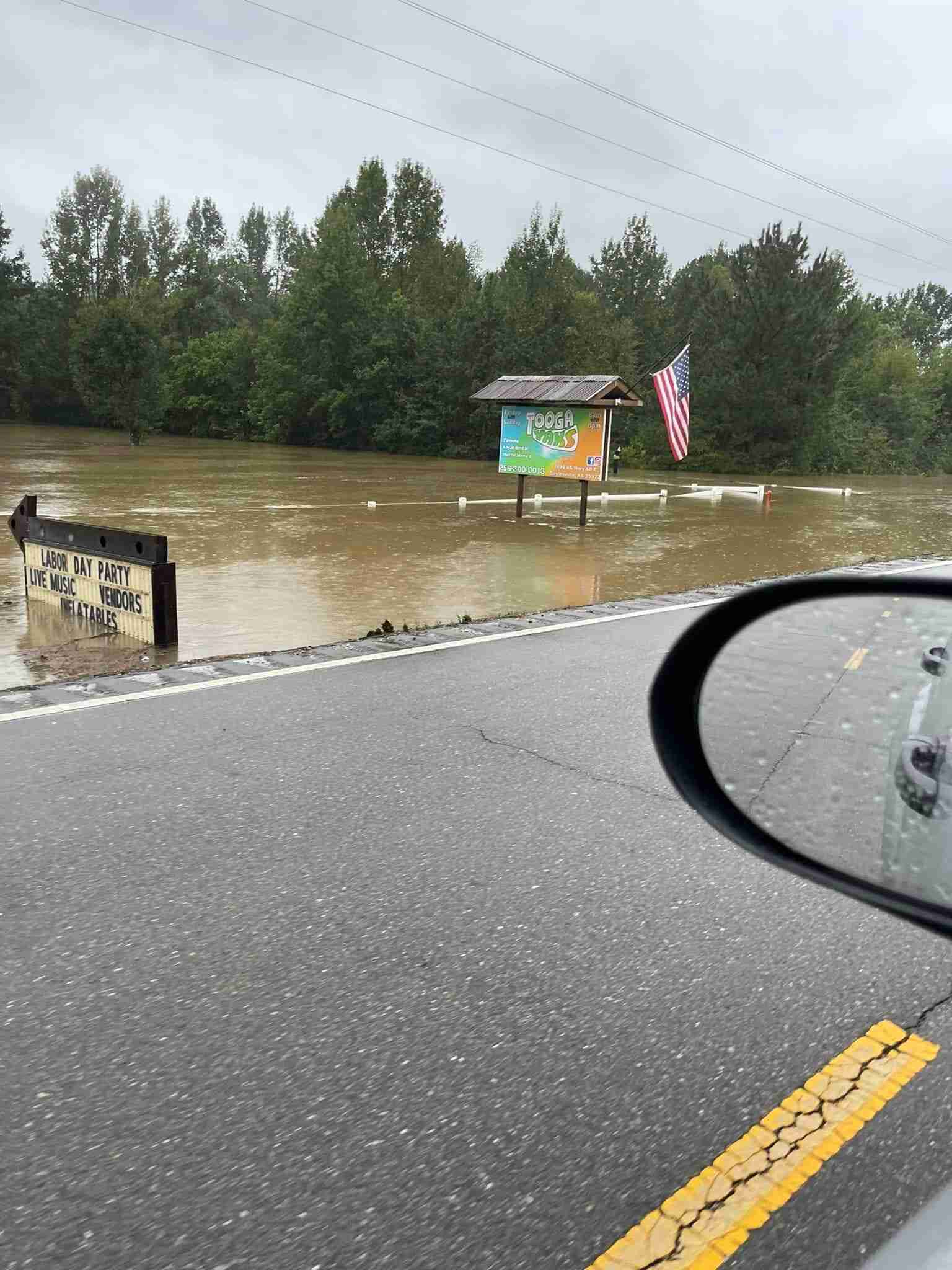
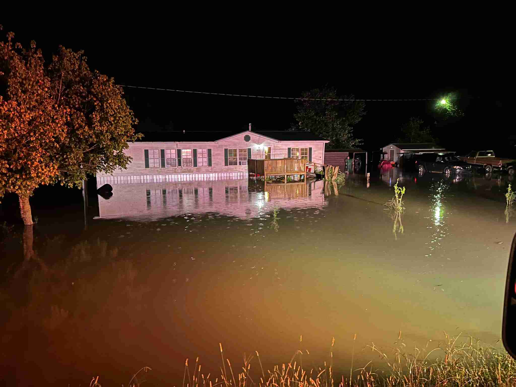
A number of trees were down across the area in addition to limbs being across roads but the biggest issue was flooding, with long stretches of highway being under water, and considered completely impassable.
Concerns remain today (Monday, September 5th) as some areas remain a danger due to rising waters. Exercise EXTREME caution.
~Information Provided by the Cherokee County Emergency Management Agency
FLOOD UPDATE AS OF 10:00pm SUNDAY
The National Weather Service has issued a Flash Flood Warning for Cherokee County until 2:15 a.m. due to rises on the Chattooga River that is creating a life-threatening situation for campers and other residents along the river NE of Gaylesville. More rain is expected later tonight in addition to the rainfall already received. County Road 140 in the Fullerton Community has been deemed impassable due to flood waters. Cherokee County Rescue Squad personnel and EMA officials have been dispatched to assist with water rescue operations in that location.
Some locations that will experience flash flooding include Cedar Bluff, Gaylesville, Cornwall Furnace Park, Eastern Weiss Lake and Fullerton.
PRECAUTIONARY/PREPAREDNESS ACTIONS
TURN AROUND, DON’T DROWN when encountering flooded roads. Most flood deaths occur in vehicles.
Be especially cautious at night when it is harder to recognize the dangers of flooding.
Flooding is occurring or is imminent. It is important to know where you are relative to streams, rivers, or creeks which can become killers in heavy rains. Campers and hikers should avoid streams or Creeks.
We want to remind everyone to use extreme caution and be vigilant when traveling especially in areas that are less traveled, watch for water across roads and bridges and NEVER drive through a flooded or washed out roadway.
We are expecting the lake level to rise to approximately 568 ft which is comparable to the flood event in 2015. We are in contact with the National Weather Service Office in Birmingham and the River Forecast Office in Atlanta.
We encourage property owners along the lake to keep a close watch on docks, boat houses, and campers/RVs over the next several hours and days.


You must be logged in to post a comment.