Hazardous Weather Outlook / National Weather Service Birmingham AL / 336 AM CDT Tue Aug 16 2022
Marion-Lamar-Fayette-Winston-Walker-Blount-Etowah-Calhoun-Cherokee- Cleburne-Pickens-Tuscaloosa-Jefferson-Shelby-St. Clair-Talladega- Clay-Randolph-Sumter-Greene-Hale-Perry-Bibb-Chilton-Coosa-Tallapoosa-Chambers-Marengo-Dallas-Autauga-Lowndes-Elmore-Montgomery-Macon-Bullock-Lee-Russell-Pike-Barbour
Outlook through Tonight.
Patchy dense fog may limit visibilities to less than 1 mile at times through 9 AM. Use caution.
Wednesday through next Monday.
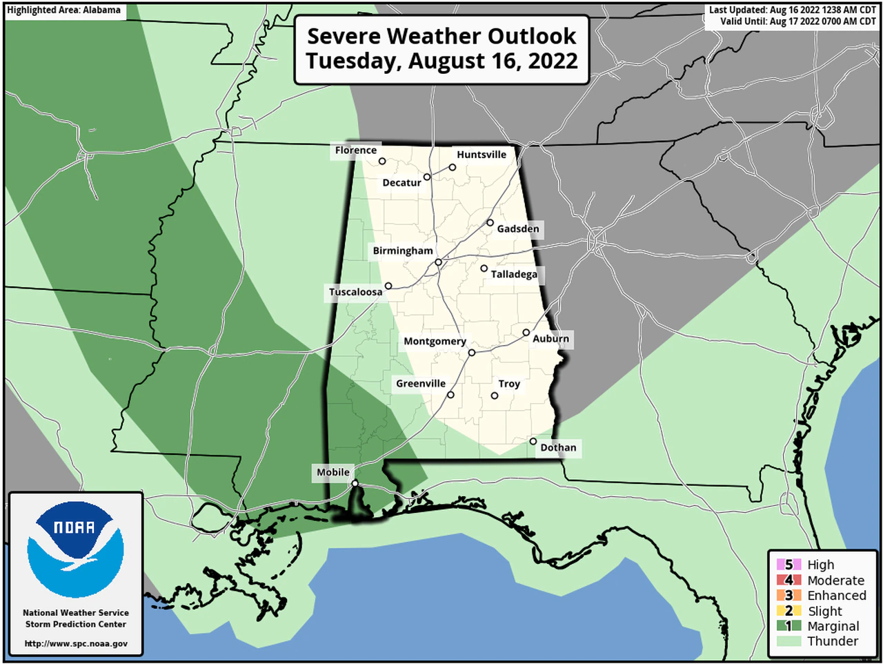
Severe storms may develop on Wednesday afternoon and evening for areas near and south of US 80 and Interstate 85. Wind gusts up to 60 mph will be the primary threat