

OVERVIEW:
A few windows for potential severe storms will exist through the week; these threats are part of a northwesterly flow pattern, which carries an inherent amount of forecast challenges; thus, tweaks to the forecast may occur.
CHANGES FROM PREVIOUS FORECAST:
Added a marginal risk for Tuesday.
HIGHLIGHTS:
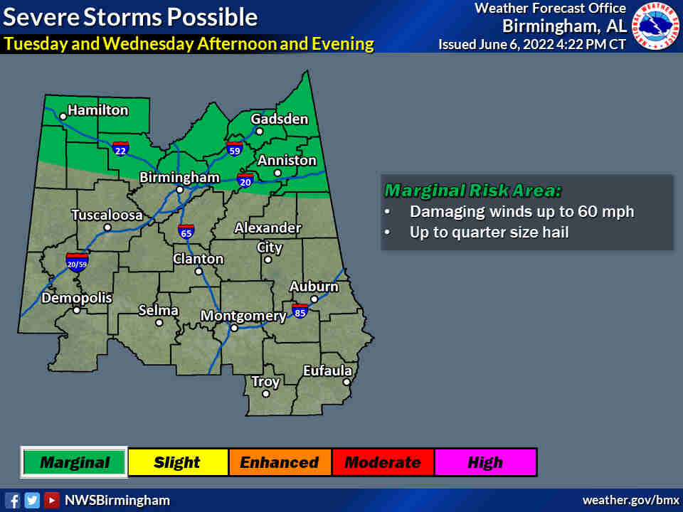
TUESDAY AND WEDNESDAY:
* Where: Northern areas of central Alabama
* When: Afternoon and evening
* Threats: Damaging winds up to 60 mph and hail up to quarter size
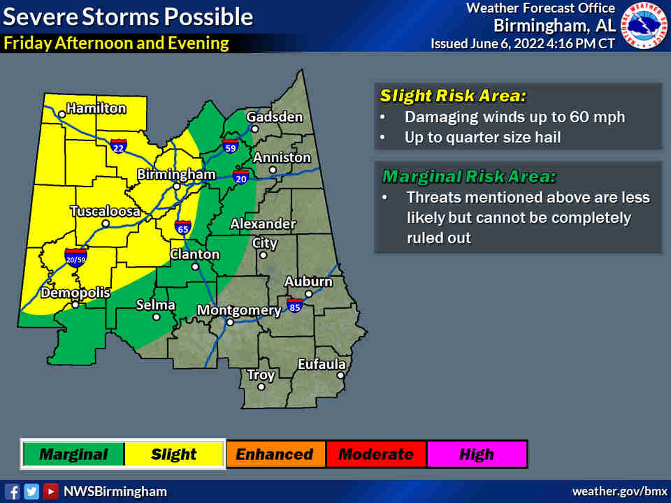
FRIDAY:
* Where: Western two-thirds, or so, of central Alabama
* When: Afternoon and evening
* Threats: Damaging winds up to 60 mph
Hazardous Weather Outlook / National Weather Service Birmingham AL / 353 AM CDT Tue Jun 7 2022
Marion-Lamar-Fayette-Winston-Walker-Blount-Etowah-Calhoun-Cherokee-Cleburne-Pickens-Tuscaloosa-Jefferson-Shelby-St. Clair-Talladega-Clay-Randolph-Sumter-Greene-Hale-Perry-Bibb-Chilton-Coosa-Tallapoosa-Chambers-Marengo-Dallas-Autauga-Lowndes-Elmore-Montgomery-Macon-Bullock-Lee-Russell-Pike-Barbour
This Hazardous Weather Outlook is for the counties served by the National Weather Service office in Birmingham.
Outlook through Tonight.
Strong to severe storms are possible this afternoon and evening hours for the northern portions of Central AL. Damaging winds and quarter sized hail will be the main threats today. Heavy rainfall may also lead to localized flooding in urban and poor drainage areas.
Wednesday through Monday.
Strong to severe storms are possible Wednesday afternoon and evening for the northern portions of central Alabama. Damaging winds and hail up to quarter size will be the main threats with this system. Heavy rainfall may also lead to localized flooding in urban and poor drainage areas.
Another system is expected to move into the area Friday afternoon through Friday night. This could lead to strong to severe storms capable of producing damaging winds for the western portions of central Alabama.
SPOTTER INFORMATION STATEMENT
Activation of storm spotters and emergency management may be needed Tuesday and Wednesday afternoon and evening and again on Friday afternoon and evening.


You must be logged in to post a comment.