 Hazardous Weather Outlook
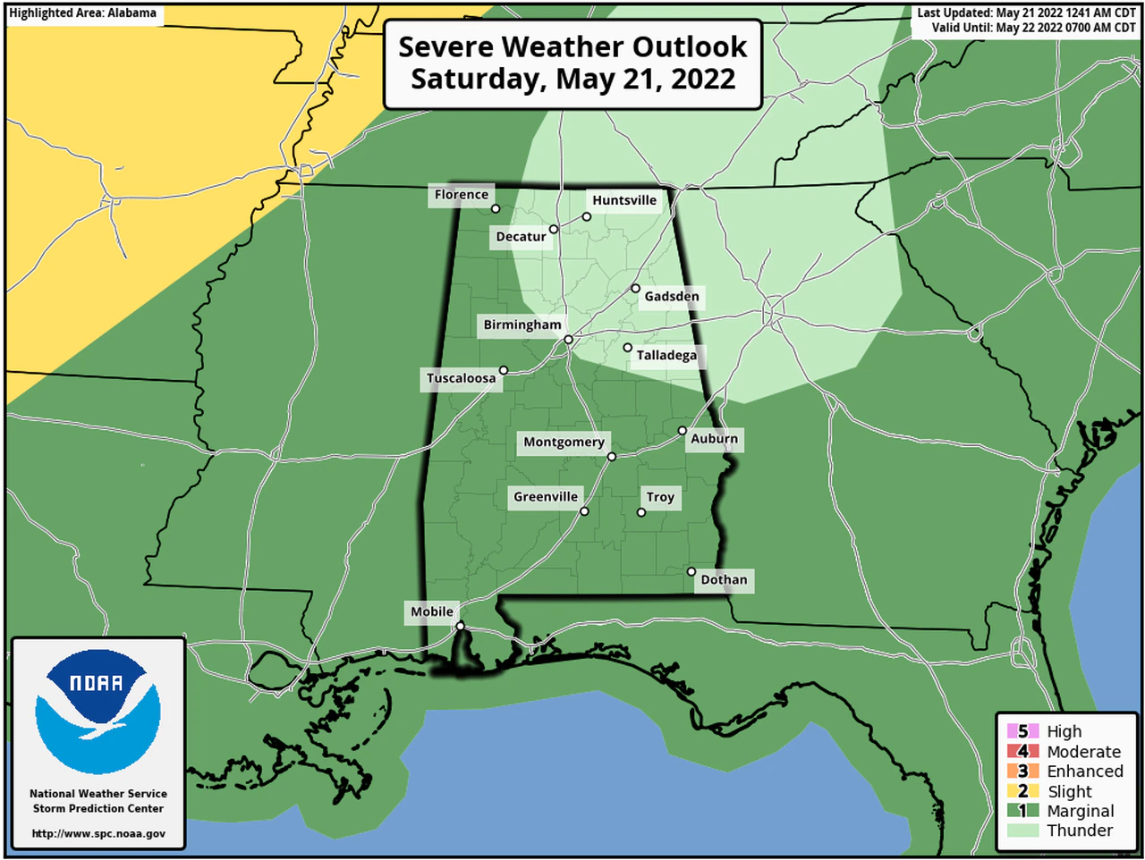
Hazardous Weather Outlook / National Weather Service Birmingham AL / 406 AM CDT Sat May 21 2022
Marion-Lamar-Fayette-Winston-Walker-Blount-Etowah-Calhoun-Cherokee-Cleburne-Pickens Tuscaloosa-Jefferson-Shelby-St.Clair-Talladega-Clay-Randolph-Sumter-Greene-Hale-Perry-Bibb Chilton-Coosa-Tallapoosa-Chambers-Marengo-Dallas-Autauga-Lowndes-Elmore-Montgomery-Macon-Bullock-Lee-Russell-Pike-Barbour-
This Hazardous Weather Outlook is for the counties served by the National Weather Service office in Birmingham.
Outlook through Tonight.
Strong to severe thunderstorms are possible across portions of Central Alabama this afternoon through 9 PM. Primary threats include damaging wind gusts and quarter size hail.
Sunday through Friday.
Strong to severe thunderstorms are possible across Central Alabama Wednesday afternoon into early Thursday morning. Primary threats include damaging wind gusts and large hail.
.SPOTTER INFORMATION STATEMENT
Activation of storm spotters and emergency management may be needed this afternoon, as well as on Wednesday.