
It’s almost become run-of-the-mill – as our forecast this week is once again calling for some very nice weather – and some very nasty weather.
That threat for severe weather – which could include damaging winds, the possibility for a tornado. hail, and flooding in select areas – will ramp up overnight across south Alabama, and the rest of the state before sunrise Tuesday. The National Weather Service is saying isolated, severe storms, could develop across southwest Alabama as early as 3:00am – and could reach the western parts of central and north Alabama as early as 6:00am.
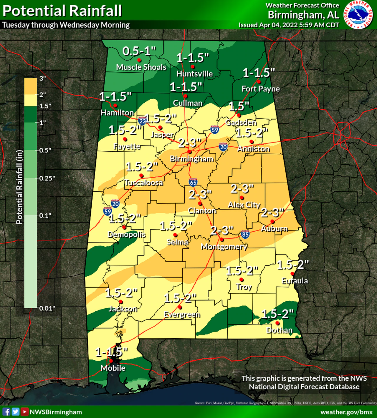
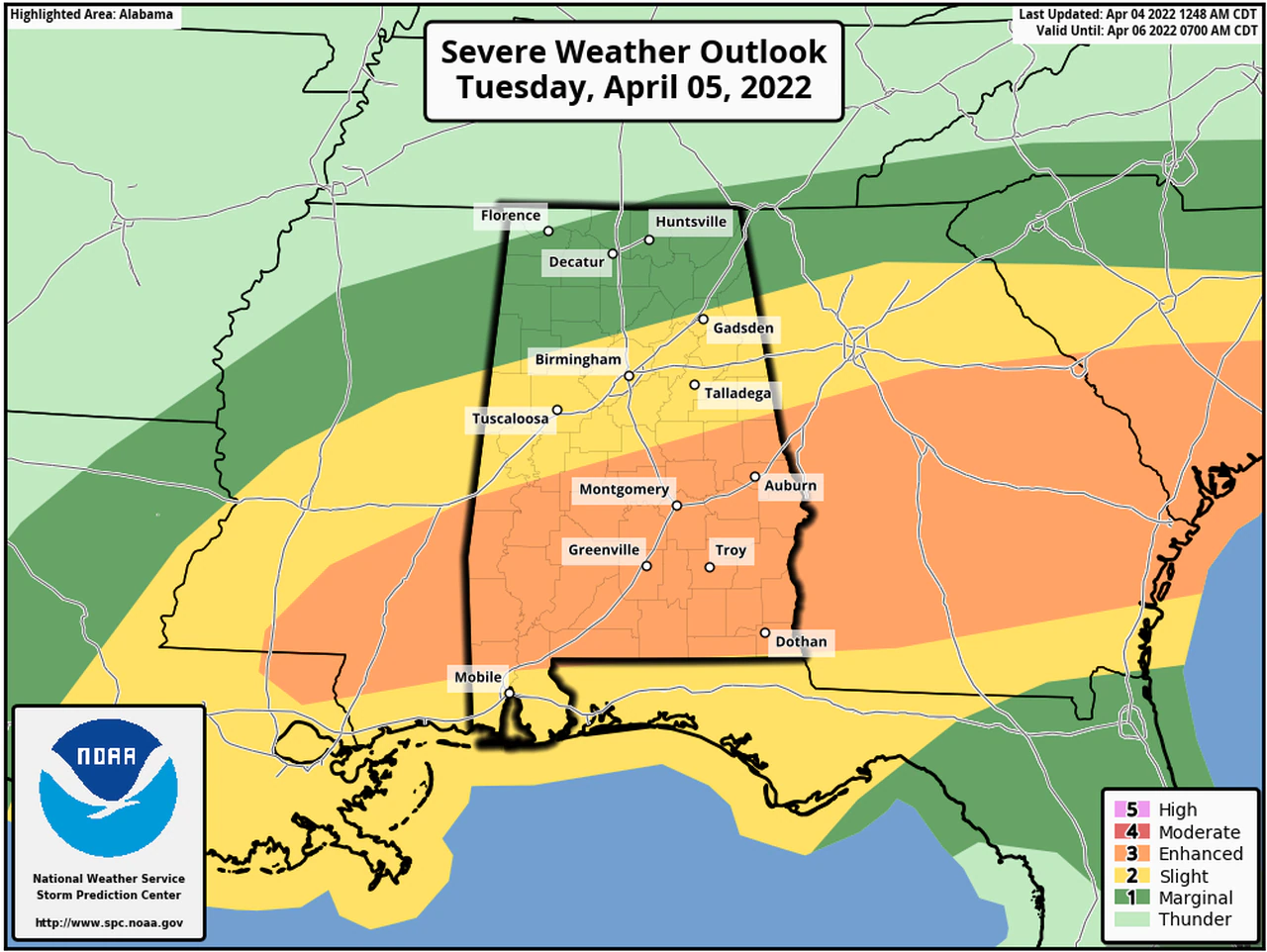
A large portion of south Alabama will be under an Enhanced Risk for severe weather on Tuesday. An enhanced risk is Level 3 out of 5 and means numerous severe storms will be possible. Almost all of the rest of the state will face either a Level 2 or Level 1 risk of severe weather. Some areas of Alabama could see up to three inches of rain through Wednesday from several rounds of storms.
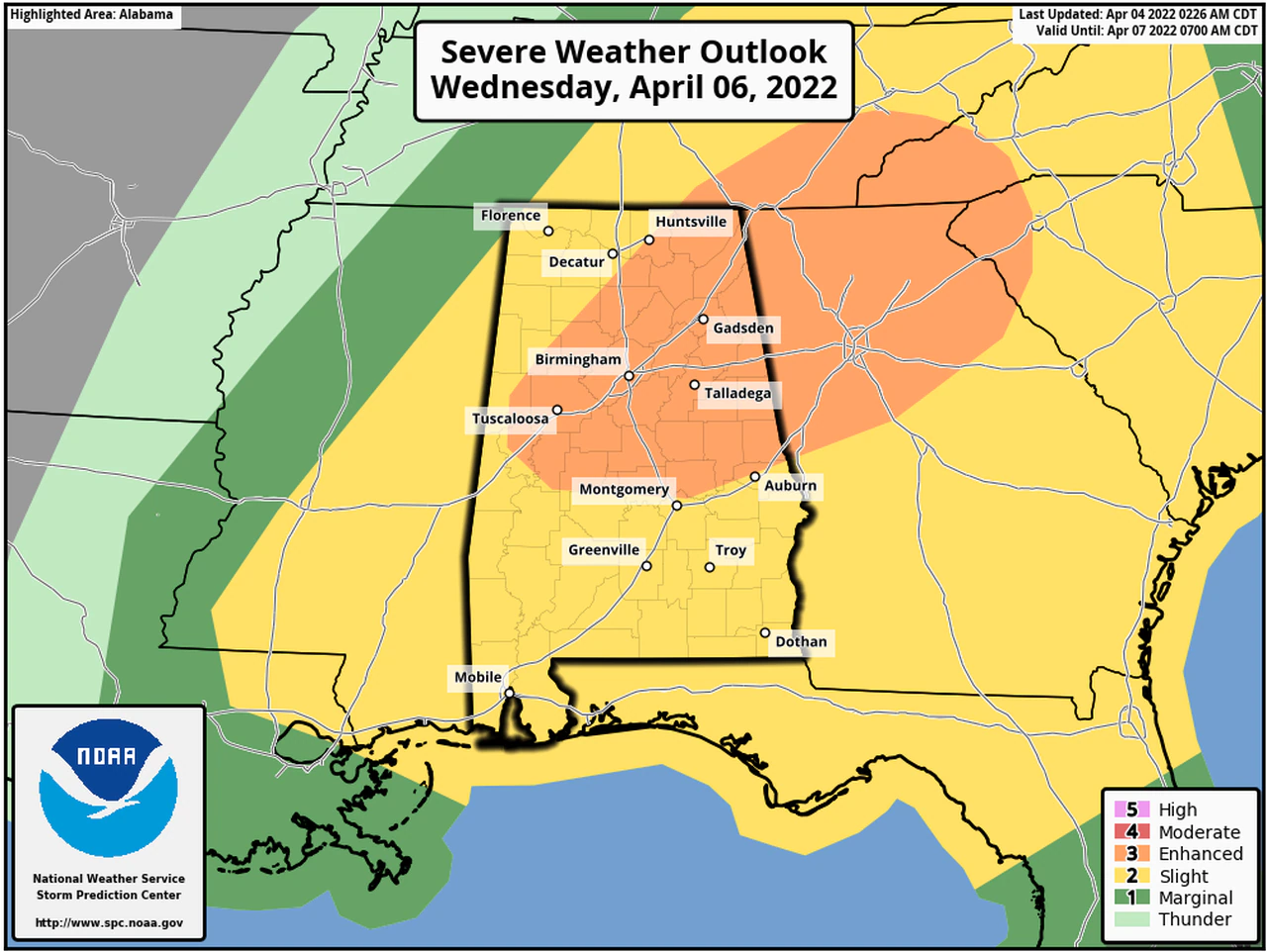
Severe storms will also be possible throughout the day on Wednesday for central and north Alabama, with a Level 3 Enhanced Risk for severe weather.
Should it be deemed necessary – ALL Cherokee County Storm Shelters will be opened at the appropriate time and will remain open for the duration of the event:
- Centre Elementary School Storm Shelter
- The New Bethel Storm Shelter
- Sand Rock Storm Shelter
- The Cedar Bluff Community Center/Fire Department (SAFER PLACE)
- The Leesburg FEMA Building Storm Shelter
Make sure you have several ways to receive Weather Alerts
Download the FREE EMA mobile app
Sign up for Code Red Alerts
Text WEATHER1 to (256) 646-5300 to receive text alerts from WEIS Radio.


You must be logged in to post a comment.