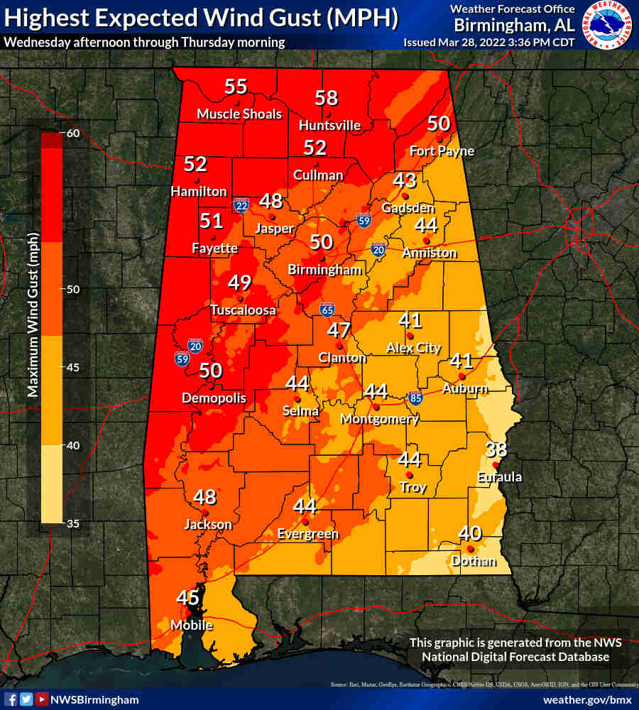
Confidence is increasing that Alabama will have to deal with another round of severe weather, this time on Wednesday. The National Weather Service said damaging winds — in some cases up to 80 mph — tornadoes, hail and flash flooding will all be possible.
Storms are expected to develop ahead of a cold front. They are forecast to move into west Alabama Wednesday afternoon and track eastward through the state through early Thursday morning.
NOAA’s Storm Prediction Center has all of Alabama in some sort of severe weather risk for Wednesday. Much of west Alabama will have an enhanced risk – which is a Level 3 out of 5 and means that numerous severe storms will be possible. The rest of west Alabama and most of the central part of the state will have Level 2 or slight risk, which means that scattered severe storms will be possible.
East Alabama will have a marginal or Level 1 risk, which means that isolated severe storms will be possible. Forecasters said this round of storms will have the potential to bring very strong winds.
The National Weather Service warned that damaging winds will be likely and there will be the potential for “numerous damage reports.”
It will also be another day where it is windy before the storms even arrive. The gusty winds combined with softer ground from recent rains raises the potential for downed trees. There will also be the potential for more rain, up to 2 inches in spots. That could lead to flash flooding in areas that got a lot of rain last week.
Drier weather is expected after the front moves out on Thursday, but rain will return to the forecast by Saturday.
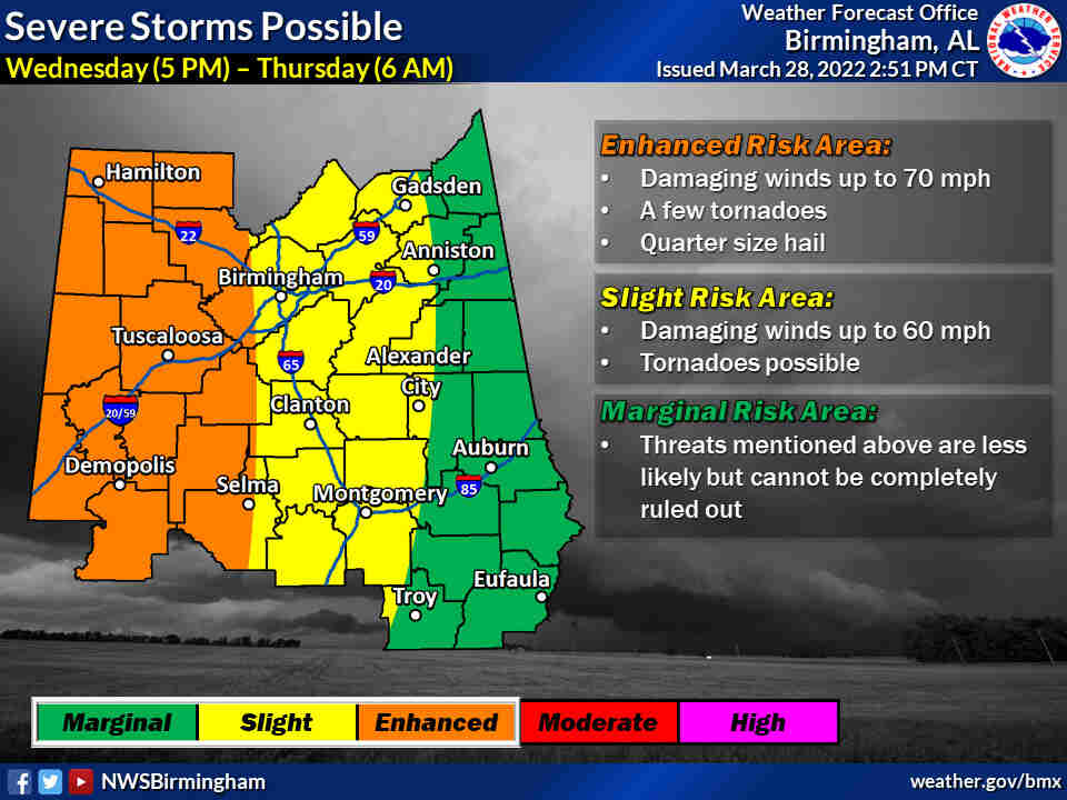
OVERVIEW:
A storm system will likely be bringing showers and/or thunderstorms to the Central Alabama on Wednesday afternoon through the overnight hours. Severe storms along with heavy rainfall is expected. Additionally, windy conditions are expected during the day on Wednesday.
CHANGES FROM PREVIOUS FORECAST:
Impact graphic now available.
WHERE:
* All of Central Alabama
WHEN:
* 5 pm Wednesday through 6 am Thursday
THREATS:
* A Few Tornadoes
* Damaging winds up to 70 mph
* Quarter Sized Hail
* Localized Flooding Potential