Alabama is bracing for another round of strong storms – with some of the state being upgraded to the “moderate” risk category.
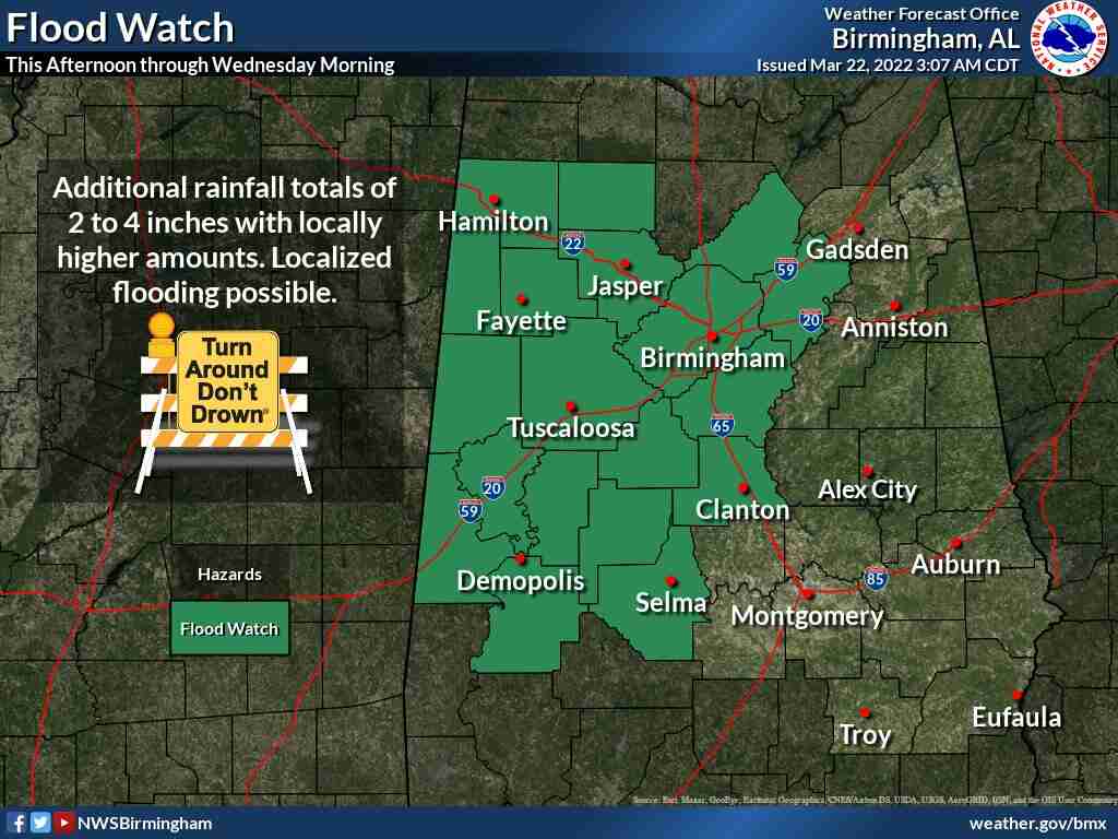
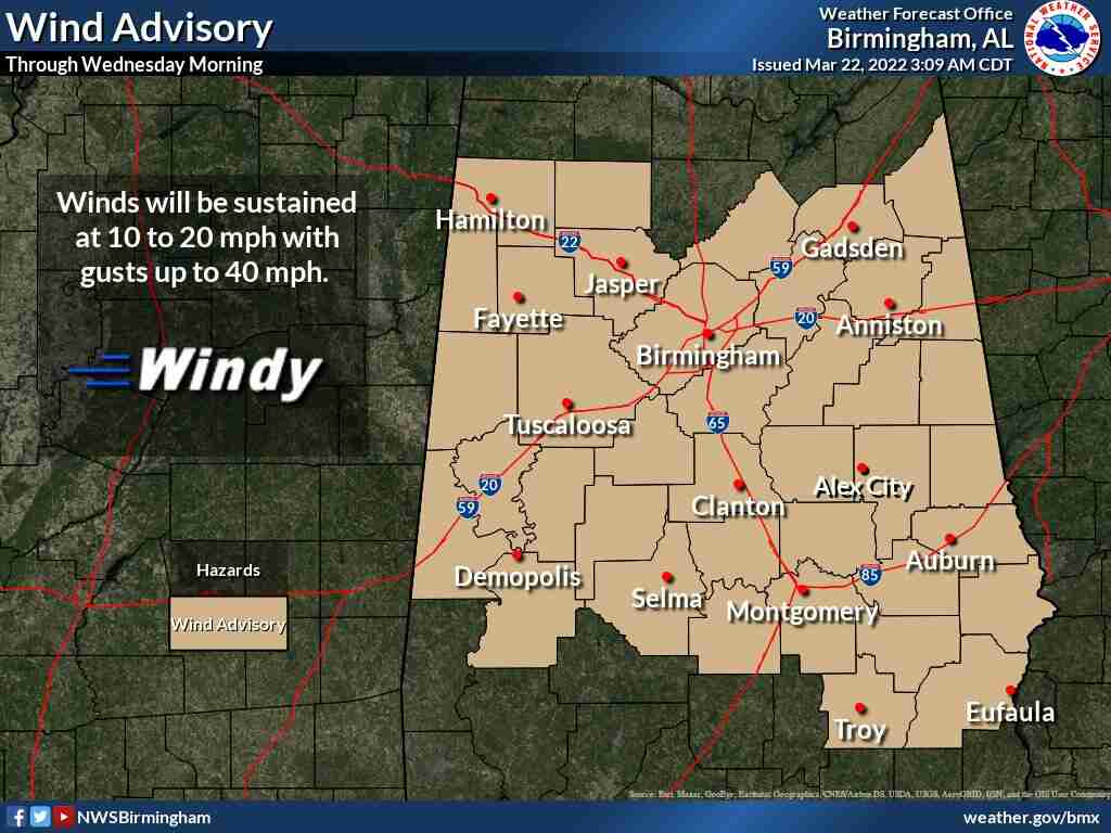
Storms are expected to start in west Alabama this (Tuesday) afternoon and then shift eastward throughout the evening and into the overnight the hours with the strongest of the storms possibly containing winds up to 70mph, hail, heavy rain and tornadoes. According to the Alabama Emergency Management Agency, a Flood Watch is in effect for the western north/central part of the state until 7:00am Wednesday; widespread rainfall of one to three inches is predicted, with three to four inches north of I-20 and west of I-65. Some spots could have even higher amounts. A Wind Advisory will be in effect for much of the state, with gusts between 30 and 40 mph.
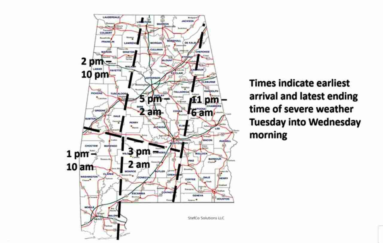
Models indicate the development of supercells in west Alabama beginning as early as 1:00pm and spreading eastward to the I-65 corridor into the early evening. Any thunderstorm that develops will quickly become severe. Then – a line of storms will move into the state between 4:00 and 8:00pm and exit the southeastern portions by 6:00am Wednesday. The north/central western part of the state from Lauderdale to Sumter counties will likely see storms starting around 2:00pm and then exit by 10:00pm. The central part of the state, from Birmingham to Huntsville, will see storms starting at 5:00pm and lasting until 2:00am before they leave the state to the east from 11:00 until 6:00 the next morning.
WIND ADVISORY IN EFFECT FROM 10:00am TUESDAY TO 7:00am WEDNESDAY
* WHAT
South winds 10 to 20 mph with gusts up to 40 mph expected.
* WHERE
Portions of central Alabama.
* WHEN
From 10:00am Tuesday to 7:00am Wednesday.
* IMPACTS
Gusty winds could blow around unsecured objects; tree limbs could be blown down and a few power outages may result.
PRECAUTIONARY/PREPAREDNESS ACTIONS
Use extra caution when driving – especially if operating a high profile vehicle. Secure outdoor objects.


